
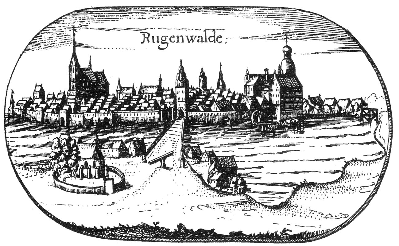
History
Darłowo (Rügenwalde) was founded in 1271 by the prince of Rugia, Wisław II, on the site of an earlier stronghold called Dirlov. Already in 1277, it was sold to the margraves of Brandenburg, who in 1307 handed it over to Peter of Nowogródek Pomorski, John of Sławno and Laurentius of Darłowo. In 1312, these knights granted the town the privilege of the Lubeck law, thanks to which Darłowo began to develop rapidly and probably already around 1320 it was surrounded by fortifications in the form of wood and earth ramparts and moats. Then, the construction of brick gates began, and by the end of the fourteenth century, the entire town was surrounded by walls.
During the Middle Ages, Darłowo was not subjected to heavy sieges, but in 1497 the fortifications could be damaged during the great wave and flood that devastated the port and part of the town. In the 16th and 17th centuries, the wooden elements of the walls were probably destroyed during numerous fires of the town, recorded in 1589, 1624, 1648 and 1679. The reconstruction was probably not conducive to plague epidemics and the military operations of the Thirty Years’ War, during which the medieval fortifications were already obsolete.
At the beginning of the 18th century, the town walls were in poor condition and threatened to collapse in many places. In 1732, the High Gate was renovated, but in the 19th century walls were completely neglected. In 1878, the New Gate was slighted. The walls themselves were largely visible until the 1930s, but unfortunately they were almost completely destroyed during the Second World War. The last fragment was demolished in 1963.
Architecture
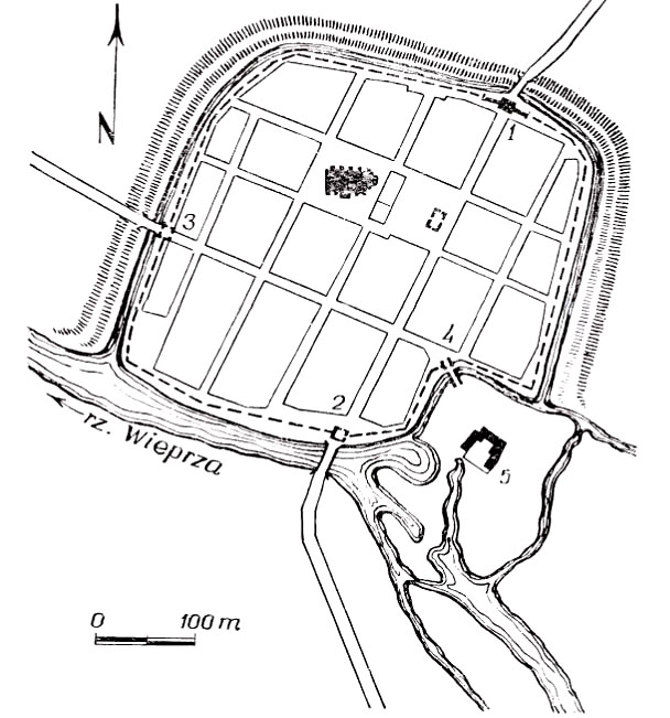
Darłowo was founded on the northern bank of the Wieprza River. The plan of the town’s defensive walls was similar to a quadrilateral with some disturbance in the area of the castle on the south-eastern side. The total length of the defensive walls was about 1500 meters, and the area of the town inside the fortifications was 14 ha. From the south, the town was protected by a river, while on the other sides there was a moat and the earth ramparts preceding it.
The walls had a covered wooden porch for guards and loop holes, which could have been the result of the late medieval modernization of fortifications. They were reinforced with regularly spaced rectangular half towers and three gate towers. In the north-eastern part of the town there was a Stone Gate leading towards Słupsk, in the western part the New Gate, and in the south, the Wieprz Gate leading towards Sławno. The wicket gate led to the castle on the Mill Island.
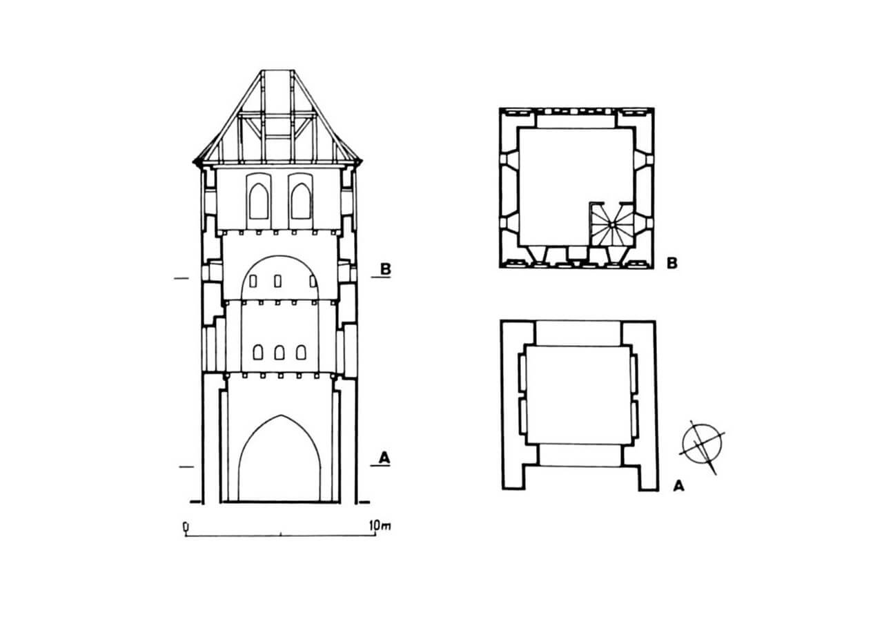
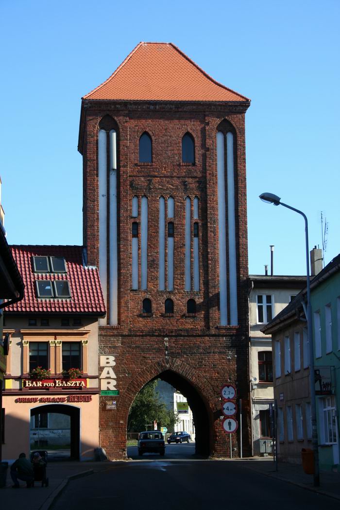
The High Gate was built on a square plan with a vertical division into four floors. It received an ogival passage in the ground floor and a roof based on Gothic stepped gables. The facades were decorated with ogival blendes and pierced with narrow arrowslits and the entrance to the wall-walk. The northern façade was decorated with four tall, lancet blendes arranged in one row, flanked by even higher double blendes. The southern elevation, facing the town, was divided by three pairs of very narrow lancet-shaped blendes, also flanked by two tall double blendes.
Current state
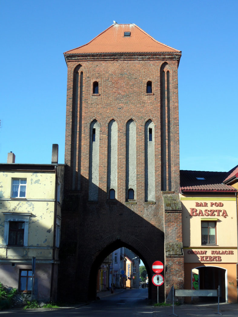
To this day, only the Stone Gate, also known as the High Gate, located at Powstańców Warszawskich Street has survived. Its current roof is the result of an 18th-century reconstruction. Unfortunately, the Gothic gables have not survived, the windows were transformed in the 19th century, and a spiral staircase was added in the north-west corner in the 1930s.
bibliography:
Architektura gotycka w Polsce, red. M.Arszyński, T.Mroczko, Warszawa 1995.
Lukas E., Średniowieczne mury miejskie na Pomorzu Zachodnim, Poznań 1975.
Ptaszyńska D., Miejskie mury obronne w województwie koszalińskim, Koszalin 1974.