
History
The Anglo-Norman castle at Caerleon was probably one of the first to be built during the conquest of Wales. It was built on the ruins of a Roman fort, probably before 1086, when the Domesday Book recorded under the name “Carleion” a small settlement and estate of Turstin FitzRolf, William the Conqueror’s standard-bearer. However, Caerleon may soon have passed into the possession of the Welsh loyal to the Anglo-Normans as part of an agreement, perhaps as a seal of an alliance to protect the borderlands and the crossing of the River Usk. The castle may have been given to Caradog ap Gruffudd, the Welsh ruler of Gwent, for whom it would have been a reinforcement in battles with rivals from Glamorgan, and for the Anglo-Normans an early warning for troubles in the west. The castle may also have changed allegiances frequently in its early years.
In 1158 Caerleon was held by the Welsh prince of Gwynllwg, Iorwerth ab Owain, who took it after the death of his brother Morgan. However, Iorwerth lost Caerleon to the English king in 1171, during the monarch’s journey to Usk and preparations for the Irish expedition. Iorwerth was supposed to have first burned the town to the castle gates in retaliation, and then in 1173, in unknown circumstances, reclaimed the castle itself. Caerleon was next recorded in 1175, when Hywel ab Iorwerth removed his uncle and rival to Caerleon by blinding and castrating him. In 1188 Giraldus Cambrensis, a Welsh monk, chronicler and writer, mentioned a “turrium giganteam”, which was either a castle keep or a Roman tetrapylon, still preserved in the ruins of the Roman town.
In 1217 Caerleon was captured by Anglo-Normans under the command of William Marshal, the first Earl of Pembroke. At William’s initiative, at the turn of the first and second quarter of the 13th century, construction work was undertaken, as a result of which the castle was rebuilt into a stone structure, probably using materials from the old Roman fort. The strengthened fortifications were able to withstand a Welsh attack in 1231. After William Marshal’s death, in 1245, the castle passed into the hands of the de Clare family. By the 16th century at the latest, it had lost its importance and began to decline. In 1661 it was already described as being in complete ruin. The large castle tower stood until 1739, when it collapsed after a period of severe frost.
Architecture
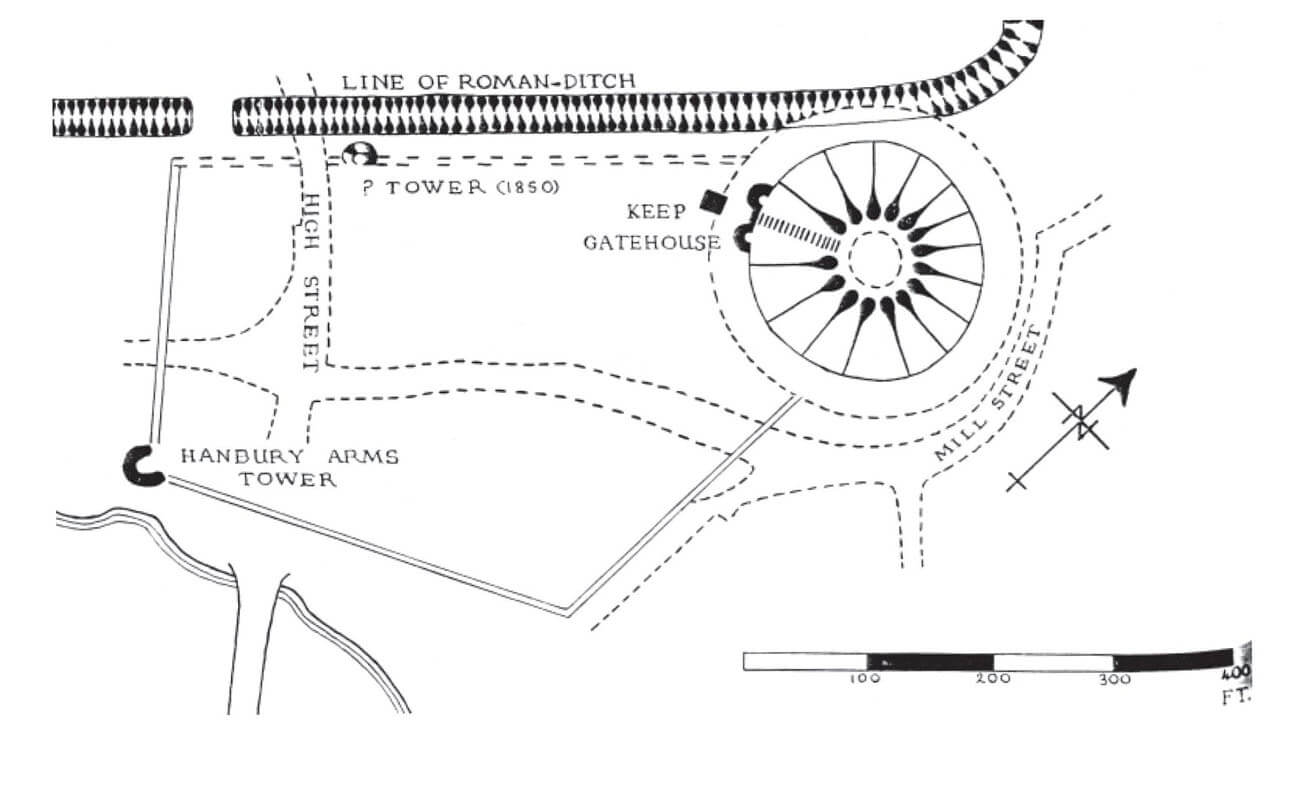
The castle was situated at the south-eastern corner of the former Roman legionary fort, north of the River Usk and its crossing, and west of the smaller Afon Lwyd, which flows into Usk. In the 11th century, the castle was a motte-type structure, with a keep placed on a magnificent earthen mound and a bailey situated on its western side. The oldest buildings of the castle were probably built of wood, although there was a lot of stone from ruined Roman buildings nearby and it could have been easily obtained for at least partial bricklaying of some elements. Both the bailey and most of the keep mound were situated on the outside of the Roman ramparts.
The keep probably originally had the form of a defensive perimeter along the edge of the hill slopes (shell keep). The mound was 65 metres in diameter and just over 16 metres high, with a top diameter of 25 metres, so it was one of the largest in the region. It was surrounded by a moat, probably with a drawbridge over it. At the beginning of the 13th century, the wooden fortifications of the keep were replaced by stone ones, and a residential – defensive tower could have been built at the top of the mound. A two-towered gate was also built at the base of the motte on the north-west side. Its gate passage was flanked on both sides by two cylindrical towers and directed towards the outer bailey.
The outer bailey covered the area on the west side of the mound with the keep. From the 13th century, it was surrounded on three sides by a stone defensive wall, which connected with the mound in two places on the east. The perimeter of the outer bailey fortifications was elongated, probably irregular in plan. At least one of the corners, the south-west one, was protected by a horseshoe-shaped or semicircular tower. Another similar tower could have been located along the northern curtain wall.
Current state
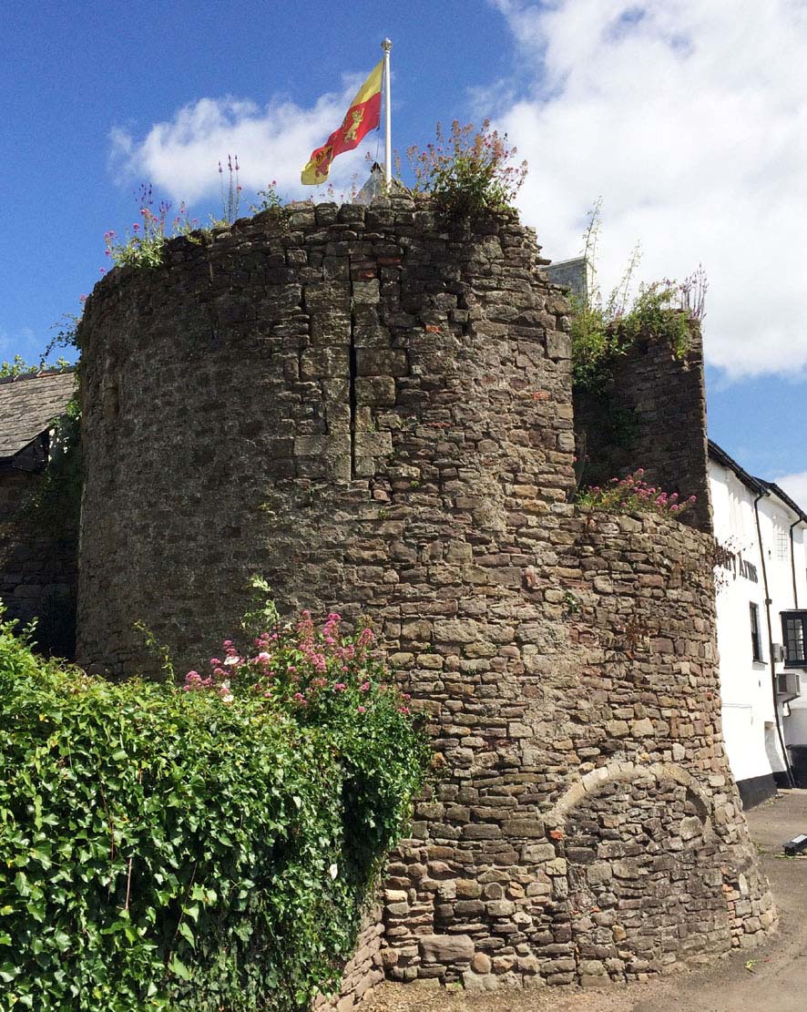
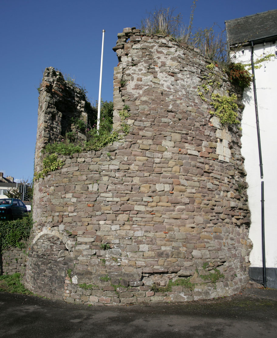
Only a single tower of the outer bailey’s fortifications from the 13th century and a fragment of the wall have survived to this day. In the private garden, fenced with a high wall and densely overgrown with trees, there is also an earth mound visible, on which the keep originally stood. Today the castle is best known from the chronicler Geoffrey of Monmouth, who suggested that Caerleon was the court of king Arthur and believed that the ruins of the Roman amphitheater are the remains of his legendary round table.
bibliography:
Kenyon J., The medieval castles of Wales, Cardiff 2010.
Phillips N., Earthwork Castles of Gwent and Ergyng AD 1050 – 1250, Oxford 2006.
Salter M., The castles of Gwent, Glamorgan & Gower, Malvern 2002.