History
The first written mention of Sabinov comes from the statute of king Bela IV from 1248. Its favorable location along the trade route leading through the Torys River valley was undoubtedly the decisive factor that attracted German colonists here. Sabinov was then a royal settlement, which in 1324, by the ruler’s decision, was removed from the jurisdiction of Šariš zupan together with Prešov and Šariš, and in 1405 was promoted to the status of a free royal town. That same year, King Sigismund of Luxembourg ordered that the town be surrounded by city walls, but work on them has not yet started for a long time.
In 1461, Sabinov was completely burnt down by the post-Hussite Czech army (bratříci), which also destroyed the town’s wooden fortifications. Even in 1472, king Matthias Corvinus had to extend the privileges so that the townspeople could rebuild the fortifications. Two years later, only the palisade and the moat were mentioned, although from the mid-fourteenth century Sabinov was described as a town (civitas). The construction of the stone defensive walls probably began only before 1481, because this year Matthias Corvinus granted the townspeople a special financial privilege, exempting them from paying all fees and taxes for four years. The construction of stone fortifications continued until the beginning of the 16th century.
In the 17th and 18th centuries, the fortifications did not undergo too many repairs and modernizations, which was why they were able to protect the townspeople only in front of the smaller units of marauders and help with the duty collection. In the first half of the nineteenth century, the fortifications were no longer maintained. The moat was changed into gardens, the walls were gradually dismantled, and the towers belonging to the town were leased to residents for economic and housing purposes.
Architecture
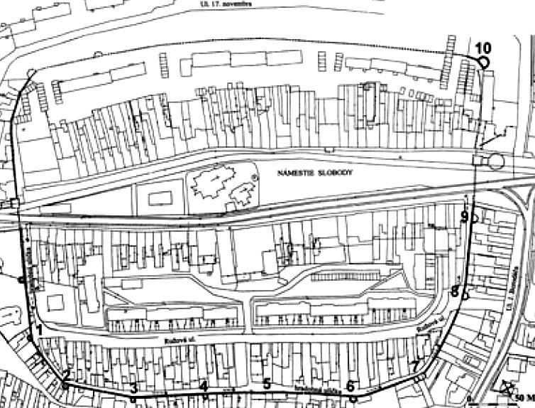
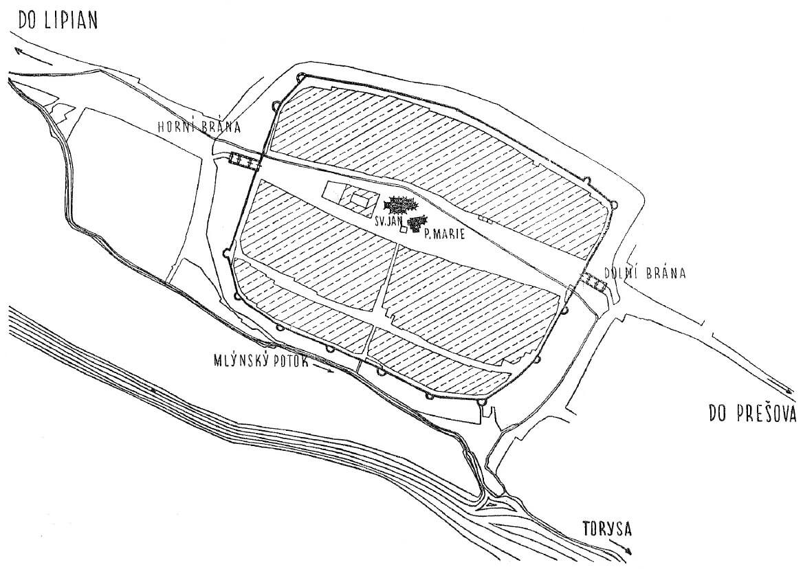
The fortifications of Sabinov were erected on a fairly regular oval plan with axes of 440 and 345 meters. In the south-west and west, the protection of the town was increased by the Torysa River, and especially by the mill canal directed from it, acting as a moat in this section. A wide, muddy (mostly unpaved) market ran along the entire length of the town, from which a street ran towards the south, crossing the southern part of the town in two halves and reaching an underwall street, running around the entire defensive circuit from the inside. It provided quick access in the event of a threat to specific places of fortifications and allowed the movement of defenders, the more important that Sabinov was deprived of a denser network of streets.
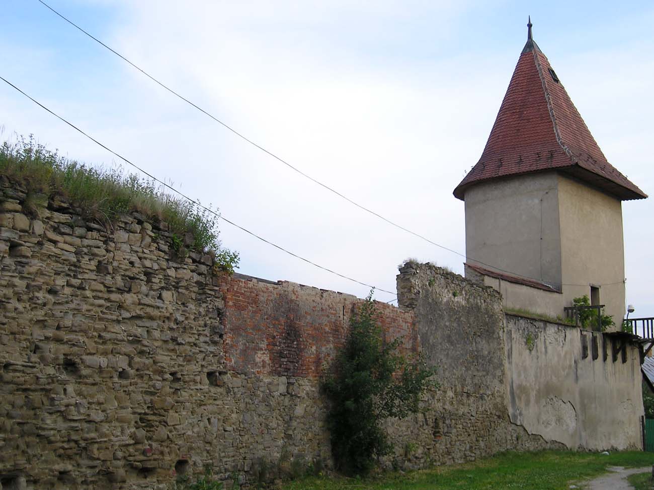
Circumference of town walls was almost 1,400 meters in length. It were 5 to 5.5 meters high plus about 2.5 meters of the breastwork defenses. Total wall height was 6.5 to 7.5 meters and 1.4 to 1.8 meters thick. They had arrowslits for small-caliber firearms (located on average every 5-5.5 meters) and a timber porch for defenders, later roofed.
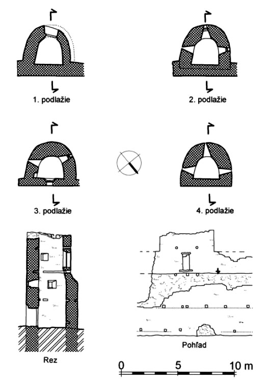
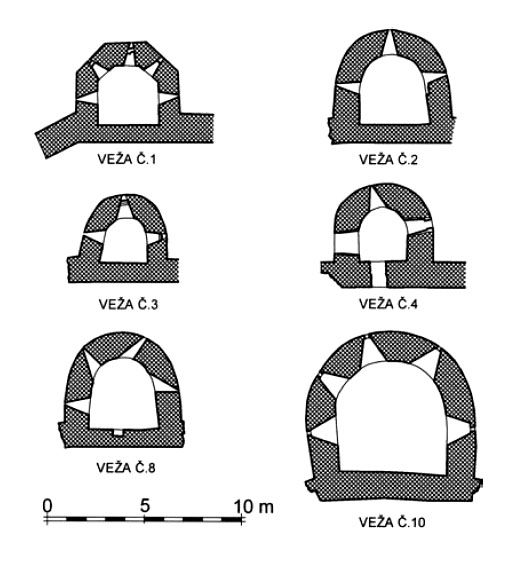
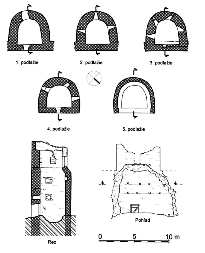
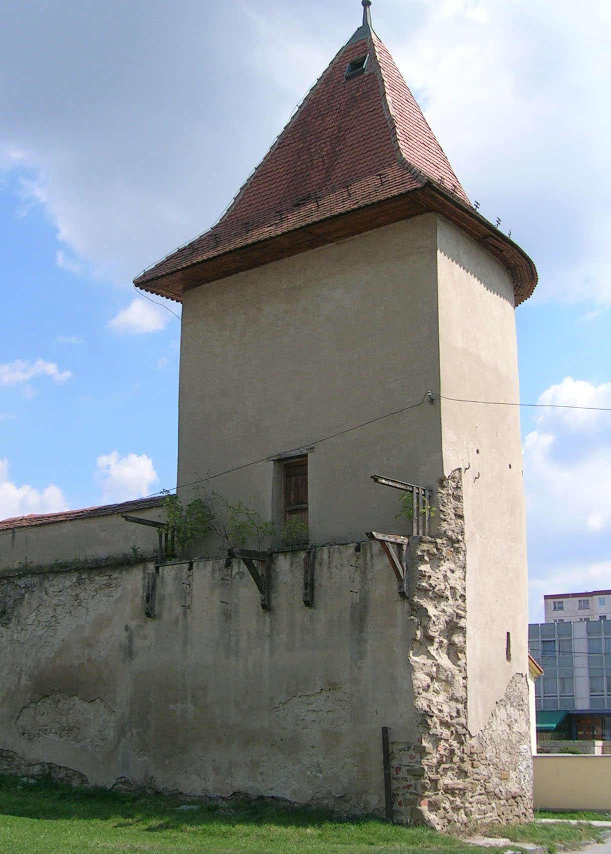
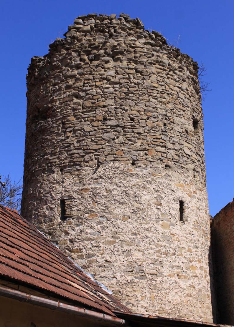
The fortifications were reinforced with horseshoe towers spaced every 50-77 meters. For unknown reasons, they were much more densely spaced from the south, and very rarely from the north, although it can not be ruled out that there were additional, currently unknown towers on north side. In the sixteenth century there were fourteen of them. They exceeded above the height of the defensive walls, were advanced in front of walls face, closed from the town side and served a flanking functions. The diameter of their semicircle was varied and ranged from 5 to 12 meters. In one known case the tower had a hexagonal floor plan (tower no. 1). They had 3 to 5 floors separated by flat beam ceilings, with two floors above the curtain wall. Originally, access to the towers was possible only from the defensive porch on the curtain walls, where in some cases stairs were used to level the tiers.
The entrance to the town was possible through two gates, one on the north-west side (Upper Gate) and one on the east (Lower Gate). Their defense was provided by four-sided, three-floor towers equipped with portcullises, drawbridges and with foregates (eastern probably in the form of a barbican). In addition, on the south side, at the end of the transverse street separating the southern part of the town, there was a smaller wicket gate, a passage to the river and to the mills. The outer zone of defense was the moat surrounding the entire town.
Current state
Six towers and around 500 meters of the defensive wall have survived to the present. In the best condition is the southern section with towers no. 1, 2, 3, 4, 8 and there are smaller relics of towers no. 5, 6, 7 and 9, however, access to part of the towers is difficult, due to modern housing.
bibliography:
Bóna M., Šimkovic M., Glos P., Neskorostredoveké opevnenie mesta Sabinov [w:] Městské fortifikace ve vrcholně středověkých zeměpanských městech střední Evropy, red. Z. Měřínský, Brno 2008.
Lexikon stredovekých miest na Slovensku, red. Štefánik M., Lukačka J., Bratislava 2010.
Mencl V., Stredoveka mesta na Slovensku, Bratislava 1938.

