History
The castle hill was inhabited around the 11th-12th century, initially perhaps only periodically. Over time, a small wood and earth stronghold was built on the site of the later castle, still in operation in the first half of the 13th century. It was destroyed by fire, which may have occurred during the Mongol invasion in 1241. The name of castle was first recorded in a document from 1390, mentioning its owner Chebda from Tropsztyn (“Ebde de Tropstein”). However, the stone castle was built at the latest at the turn of the 13th and 14th centuries. It was probably founded by Gniewomir or his father Zbrosław, the then heirs of the village of Tropie.
The southern part of the castle was probably destroyed in the 14th century by a landslide of a rocky cliff. The reconstruction was carried out by the heirs of the village of Tropie, perhaps Andrzej Chebda of the Starykoń family, who came into possession of the castle in the last quarter of the 14th century. The construction work was supposedly continued by Andrzej’s wife in the first half of the 15th century, at whose initiative the utility wing with a kitchen could have been built. The strengthened and enlarged Tropsztyn was recorded in documents in 1404 as a “castrum”.
The castle belonged to the Chebda family until 1535. At that time, Prokop Chebda sold the already declined building to the Sandomierz castellan Piotr Kmita from Wiśnicz. Shortly afterwards, the castle was ruled by the Robkowski family, and then the representatives of the Gabańscy family, who probably rebuilt the dilapidated building. However, at the beginning of the 17th century, Tropsztyn was completely ruined.
Architecture
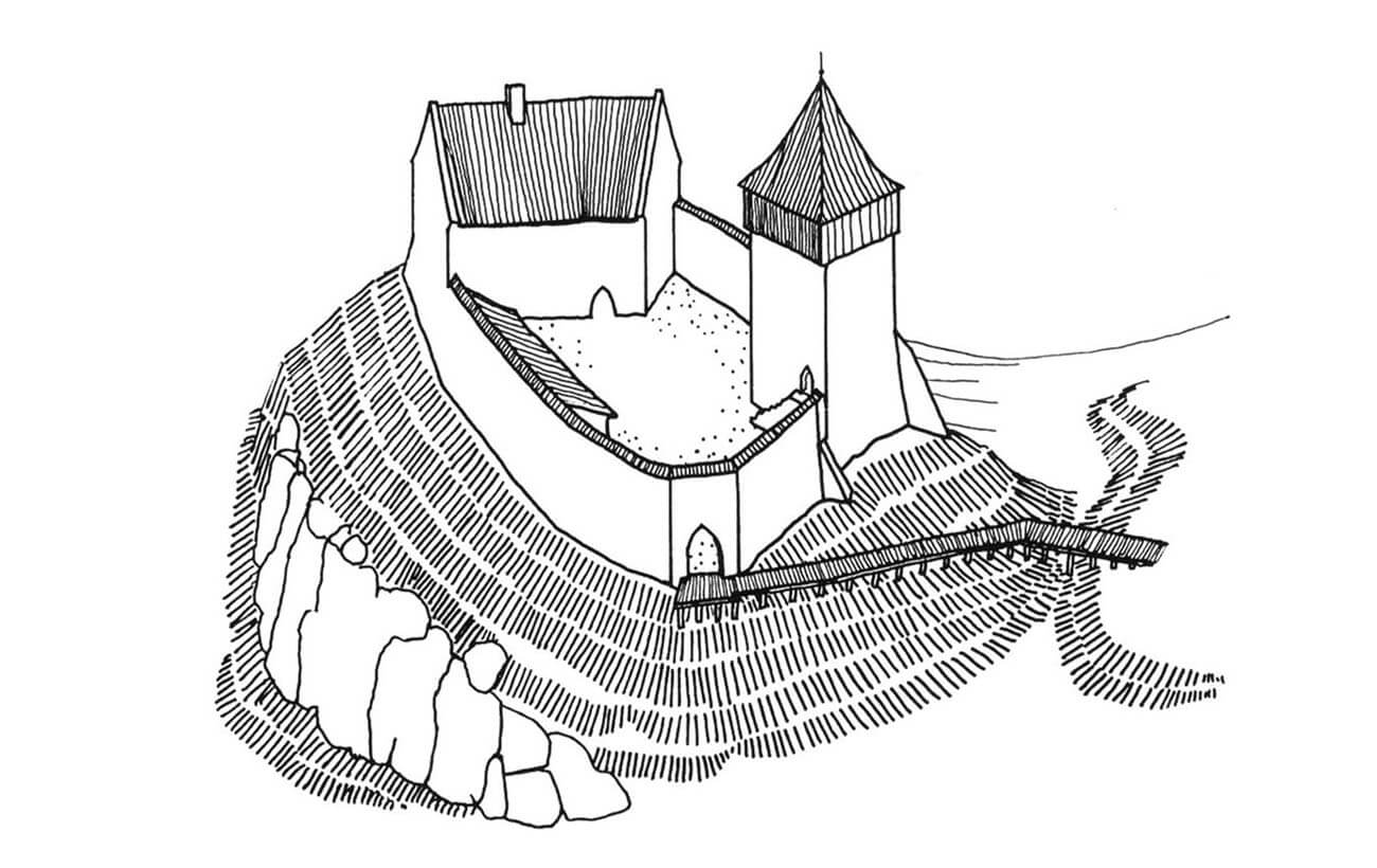
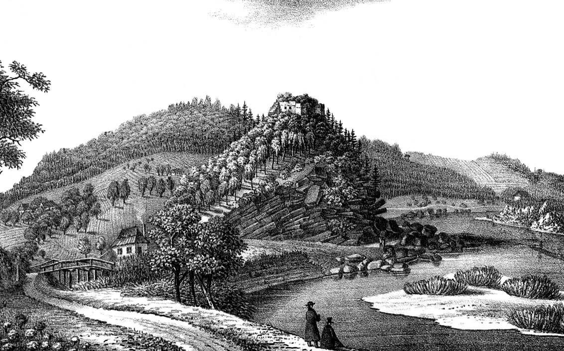
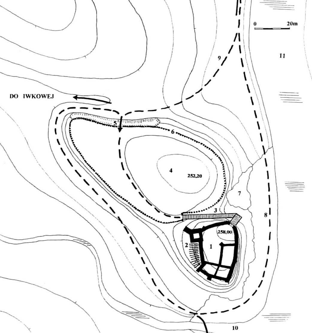
The castle was built on a hill at the mouth of a narrow valley, through which the Iwkowski stream flowed from the west, connecting with the Dunajec River on the eastern side of Tropsztyn. The stone core of the castle occupied the highest, promontory-like point of the hill, while on the north-west side there was a 6-meter lower outer bailey with a wooden or half-timbered structures. Both parts were separated by a ditch, which was partially created using the natural form of the terrain. The whole was limited from the south by the stream, and from the east by the river, which turned from the east to the north-east in a deep bend under the castle. The main part of the castle dominated it with a height of about 25-30 meters. On the opposite bank of the river there was a Romanesque church associated with the cult of St. Zorard.
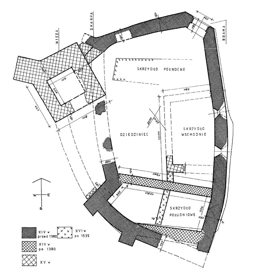
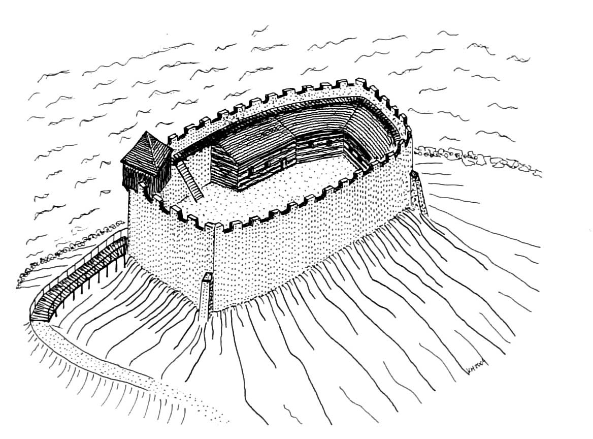
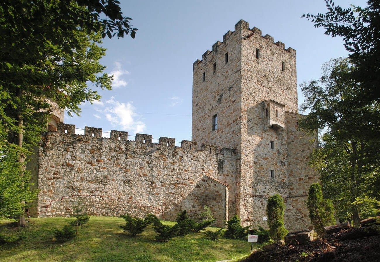
Probably at the end of the 13th century, a defensive wall in the shape of an irregular oval of about 22 x 32 meters was built of sandstone on a rocky outcrop. It was built along the edges of the slopes, adapted to the shape of the terrain, and probably also to the course of the older earth rampart of the stronghold. The western section of the wall was also reinforced from the outside with an earth rampart. Wall had a variable thickness along its entire circumference, from 1.6 to 2.1 meters. It was probably topped by a wall-walk, protected by a battlemented parapet. The gate was built in the shortest section in the north-eastern corner. It could be reached only by a wooden ramp, running along the northern slope. Between the ramp and the gate there was a drawbridge, the counterweight of which, when raised fell into a specially made pit. The interior of the courtyard was originally filled with wooden buildings. The residential house could have been built in the southern, safest part of the courtyard, on the opposite side of the gate.
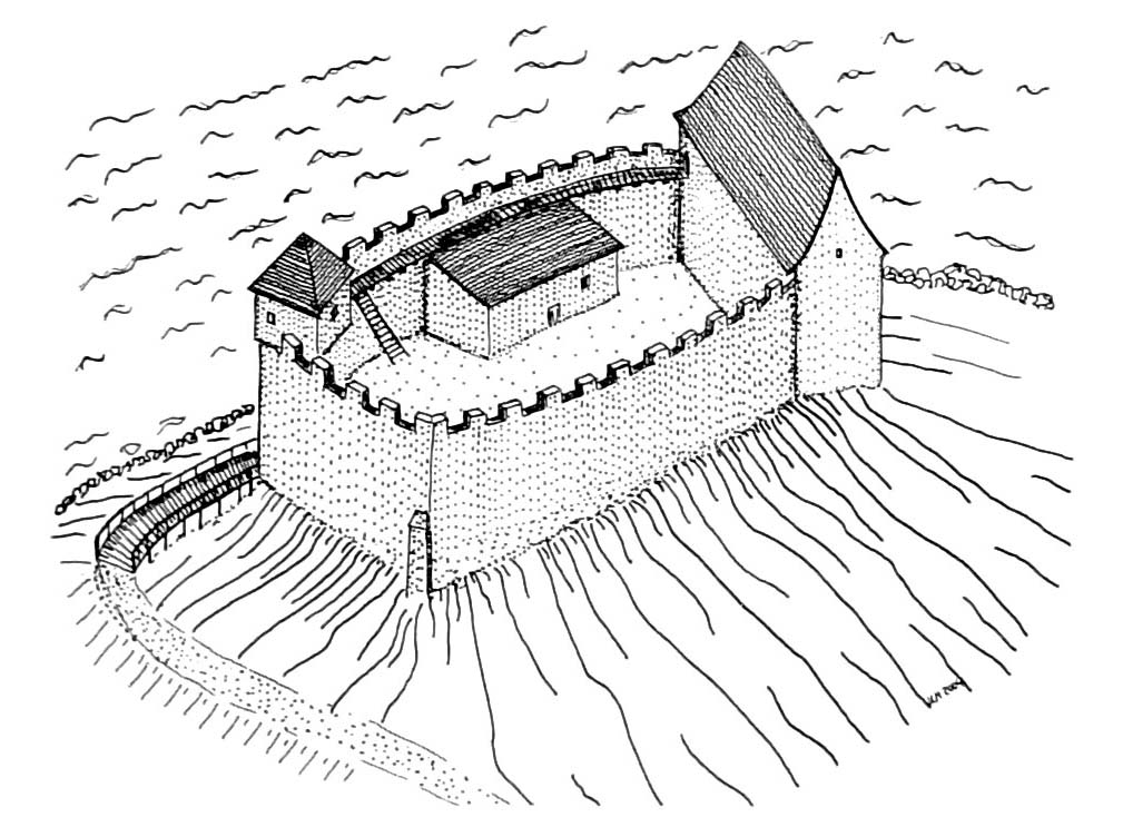
At the end of the 14th century, a stone residential building was erected on the southern section of the wall, on the plan of an irregular, elongated pentagon. It had at least two storeys and was sunk into the rocky substrate by 1.2 meters. At the beginning of the 15th century, excessive loading of the promontory or washing its base by water, caused part of the rock to slip and the corner part of the castle to collapse. The house was rebuilt, while its usable area was reduced. Perhaps for this reason, it was decided to build a new wing, added to the eastern section of the defensive wall. This building had a kitchen on the ground floor with a large stove in the north-eastern corner. There must have been at least one storey above it, accessible via an internal staircase. Since there were originally two loop holes facing the river in the section of the utility wing in the defensive wall, after the kitchen had been built, it was decided to brick them up.
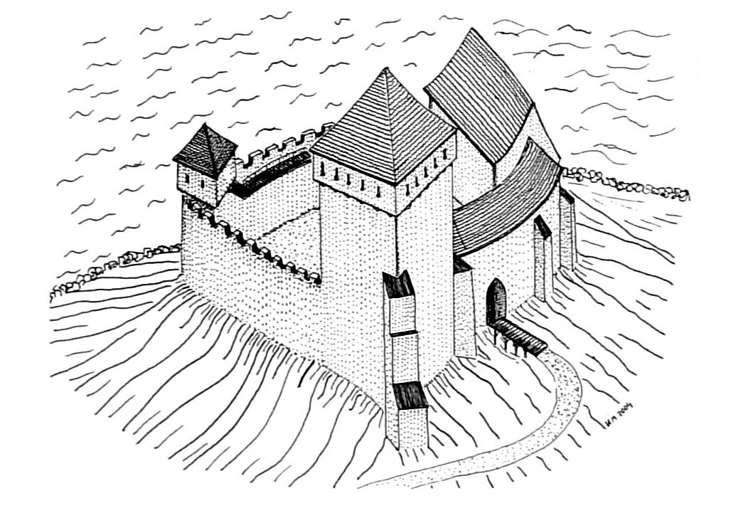
In the 15th century the defensive system was reinforced by a tower on a square plan, built in the north-west corner. It was strongly protruding towards the rampart and the slope of the hill, and probably for this reason supported by a massive corner buttress. Tower could have had four or five storeys, including basement. Initially, together with the southern residential building, it created the so-called bay in the western section of the castle, advantageous for defensive reasons. In the second half of the 15th century, this place was used after the entrance to the castle courtyard was changed. The old gate was bricked up, and the new western one was preceded by an external wall in the early 16th century, which created a kind of narrow foregate or gatehouse. The north-eastern part of the courtyard, freed from its communication function, was occupied by the third wing, situated with its longer axis perpendicular to the eastern wing.
Current state
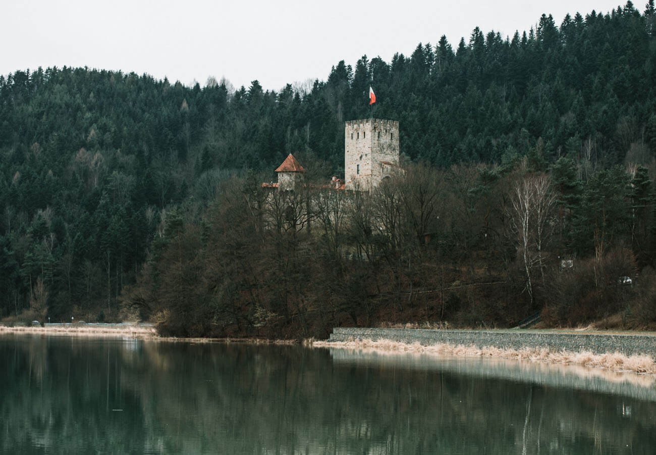
The castle did not survive to the present day. Until the 1990s, only relics of its ground floor existed on the castle hill, reaching above ground level up to 2 meters in the case of the defensive wall, and up to 4 meters in the case of the tower. Then, after passing into private hands, a reconstruction was carried out, or rather a completely new building was erected, also using modern methods and materials, referring to the original castle, but extravagantly equipped with a helicopter landing pad. Currently, not only the buildings on the hill are a modern creation, but also the appearance of the surrounding areas has been changed, as a result of the damming of the Dunajec River and the creation of Lake Czchowskie. The area of the former outer bailey was destroyed as a result of the construction of a road and the construction of modern buildings. The original sections of the walls are easily visible from the outside due to the separation with a red joint.
bibliography:
Dworaczyński E., Zamek Tropsztyn [in:] Późne średniowiecze w Karpatach polskich, red. J. Gancarski, Krosno 2007.
Kołodziejski S., Średniowieczne rezydencje obronne możnowładztwa na terenie województwa krakowskiego, Warszawa 1994.
Leksykon zamków w Polsce, red. L.Kajzer, Warszawa 2003.
Moskal K., Zamki w dziejach Polski i Słowacji, Nowy Sącz 2004.

