

History
Fortifications of Świecie (Schwetz) were built in the second half of the fourteenth century, after the town was moved to the other side of the river in 1338, near the Teutonic castle. Construction works on the brick town walls began in 1375, and due to their great importance for the castle’s defenses, construction was financially supported by the Teutonic Grand Master and commander of Świecie. 1110 fines were spent on erecting the fortifications, of which two-thirds came from the municipal coffers and one-third of the costs were covered by the Teutonic Knights. In addition, in 1441 the fortifications from the Grand Master’s foundation were reinforced with a wooden palisade, probably a rather makeshift fortification, erected during a period of increased danger.
The town walls functioned and were in good condition for quite a long time, because they were treated as flood protection. Floods hit the Świecie quite often. In 1445, the flood destroyed urban meadows and fields, which forced some of the residents to leave the town, subsequent floods hit the Świecie and its surroundings in 1496, 1540, 1674, 1745, 1813 and 1816. In the autumn of 1410, the vicinity of the town was devastated by the Polish troops withdrawing from Pomerania, and in 1455 fortifications did not protect the townspeople from burning by mercenaries of Teutonic Knights.
In the seventeenth century, the town walls were no longer a major obstacle to early modern troops, which contributed to the destruction of the town during the Polish-Swedish wars and the Swedish Deluge, during which in 1656 the Swedes completely burned the town. Again, Świecie was occupied by the Swedish army during the Northern War in 1703. In 1855, the great flood of the Vistula led to the destruction of the south-eastern corner of the fortifications. Large fragments of fortifications were demolished shortly after, in connection with another translocation of the town after 1866.
Architecture
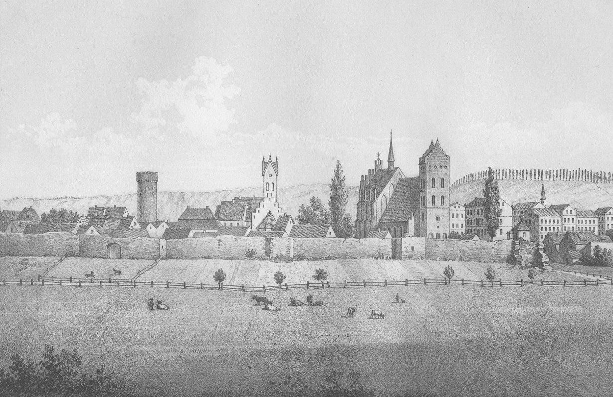
The town after the translocation from 1338 was founded between the Wda and Vistula rivers (closer to the banks of the latter), west of the Teutonic castle and its outer ward, located at the very end of the promontory. Thanks to this, the town walls were an additional protection for the castle, and it were significantly protected by terrain natural conditions. Both the town and the castle were separated from each other by an irrigated moat, on the southern side a port suburb with a river port and granaries developed between the town walls and the Vistula River, while in the second half of the 15th century the settlement began to develop in the outer ward, adjacent to the town walls. The area in front of the Chełmno Gate was occupied by meadows and a horse pasture. In 1421 it was divided into gardens, which were randomly allocated to urban plots. The gardens were also located in the northern suburb stretching on the hills in front of the Bridge Gate. Vineyards, brickyard and lime kiln were also located in this area.
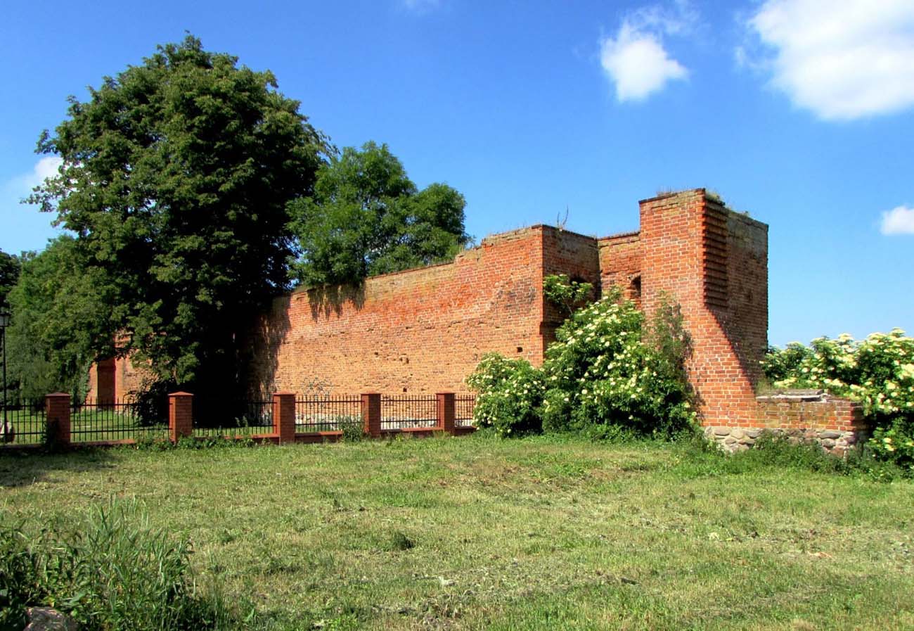
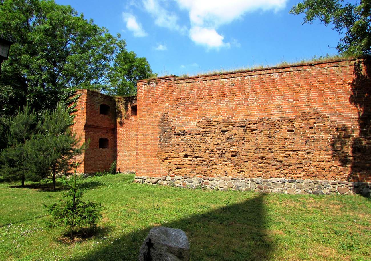
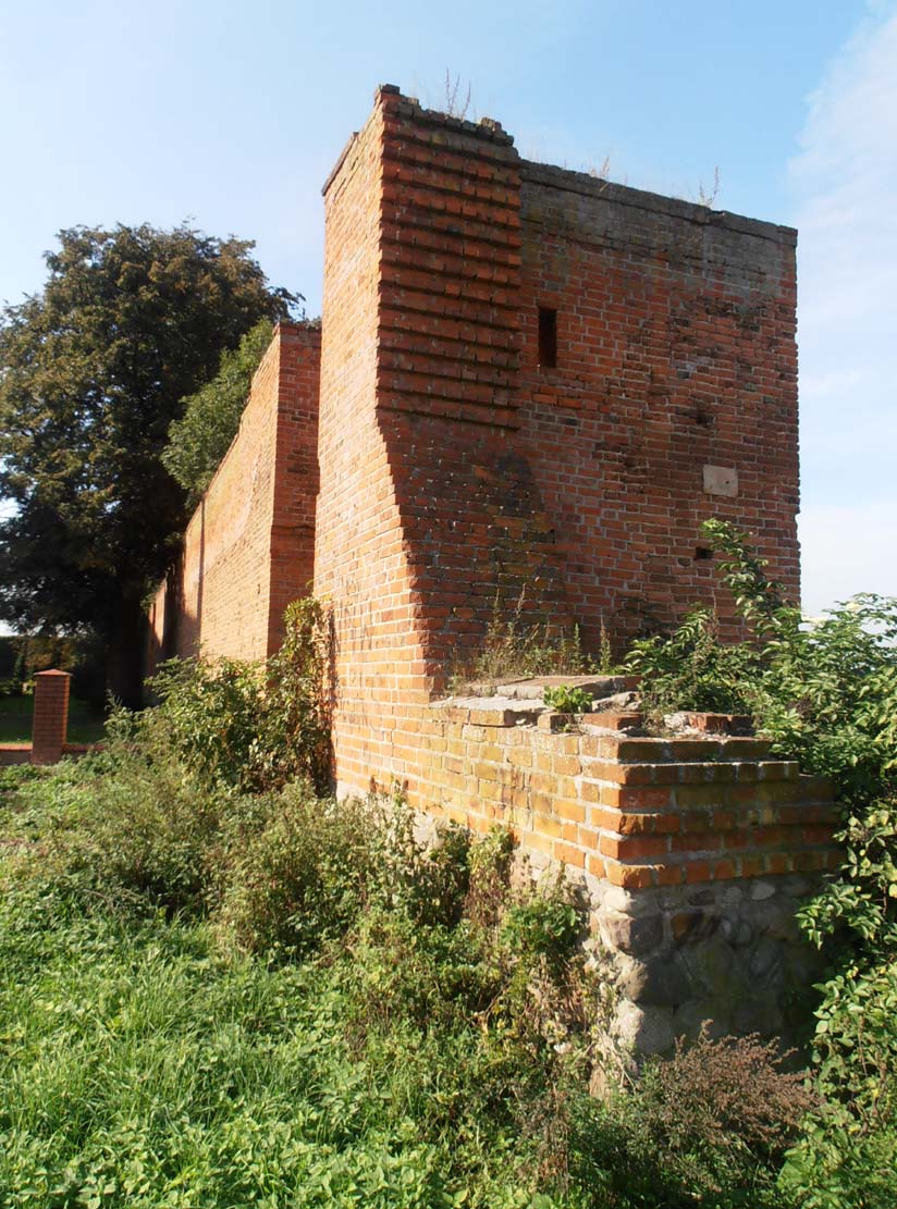
The circumference of the defensive walls was in the shape of a rectangle 350 meters long and 125 meters wide, extended along the east-west line. It included a regular network of streets with a spacious, four-sided market square in the center, while almost the entire perimeter of the street was an underwall street, possibly separated by a cemetery wall in the area of the parish church in the western corner of the town. Wall was strengthened by about 19 three-sided half towers, open from the inside, located most frequently from the most endangered parts: the north and west. Towers were fully extended in front of the adjacent curtains, probably equal to them in height or higher by a maximum of one storey. A single ring of walls in 1441 was additionally reinforced with a palisade set up in the foreground.
Three town gates led to the Świecie: the Castle Gate from the north-east, which led towards the outer ward, the Bridge Gate (also known as Grudziądz Gate) providing connection with the Old Town on the right bank of the Wda River on the north side, and the Chełmno Gate from the south. The Chełmno Gate was more representative, decorated with granite architectural details, while the Bridge Gate was provided with a foregate, connected to the bridge and gatehouse located on the opposite side of the Wda River, where the fortified bridgehead was placed.
Current state
Until today, a fragment of the defensive wall with the open half towers, near the parish church, has been preserved. Admission to the area is free, wall is not covered by any buildings due to the town being moved to the other side of the river in the 19th century.

bibliography:
Atlas historyczny miast polskich. Tom 1 Prusy Królewskie i Warmia, red. R.Czaja, Z.Kozieł, zeszyt 6 Świecie, Toruń 2012.
Die Bau- und Kunstdenkmäler der Provinz Westpreußen, der Kreise Marienwerder (westlich der Weichsel), Schwetz, Konitz, Schlochau, Tuchel, Flatow und Dt. Krone, red. J.Heise, Danzig 1887.
Dzieje Świecia nad Wisłą i jego regionu, red. K.Jasiński, t. 2, Warszawa 1980.