History
The castle was probably built at the end of the 13th century. It was first recorded in documents in 1312, when a privilege issued by Władysław Łokietek allowed the Poor Clares from Stary Sącz to collect customs duties under the “Ritter” castle. During Łokietek’s time, the castle belonged to the royal domain and protected the customs chamber on Poprad. For unknown reasons, it burned down in the 14th century, after which it was expanded, first by a stone wall, and then by a stone residential building. From the beginning of the 15th century, it remained in the hands of tenutaries: Jakusz from Boturzyn of the Czewoja family, and after him by representatives of the Toporczyk family, who took the Ryterski surname from the castle. Probably one of the members of this family financed the rebuilding of the castle gate, which was strengthened around the fourth quarter of the 15th century. In the 16th century, the castle was administered by Piotr Kmita, one of the richest and most influential people in Poland. Probably during his time, around the mid-16th century, the castle burned down again in unexplained circumstances. The last tenutary, Stanisław Garnysz, subdapifer of King Sigismund Augustus, did not attempt to rebuild the castle, which soon fell into complete ruin.
Architecture
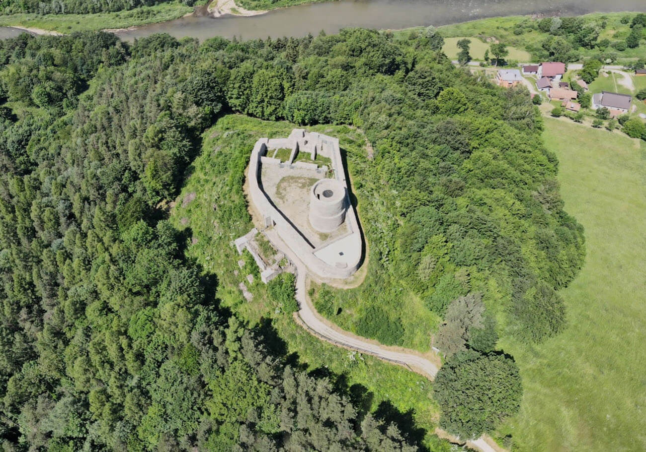
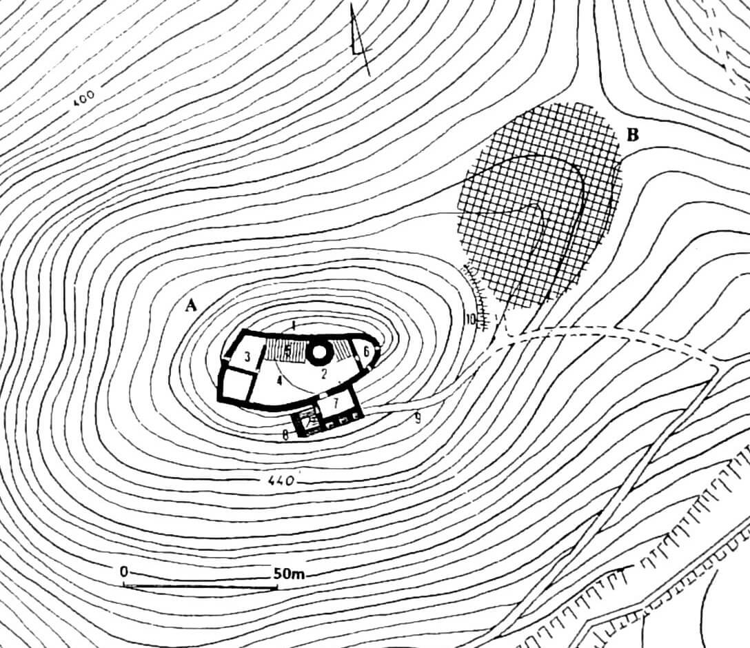
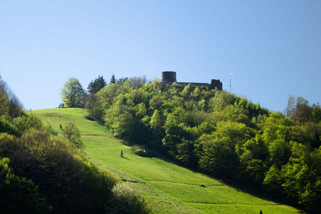
The castle was situated on the right bank of the Poprad, on a high hill jutting out like a promontory from the higher Makowica massif. Steep slopes protected the castle from the west, where it descended towards the river, and from the north and south, in places of two ravines. The gentlest approach led from the east, through the pass connecting the castle hill with the high slopes of Makowica, where the timber outer bailey was located. The road to the castle ran along the southern slope, and then through the pass on the southern side of the bailey to the west. At the foot of the castle from the side of the bailey there was an earth rampart, preceded by a ditch.
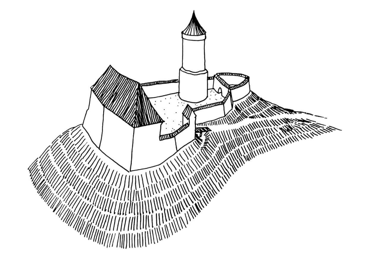
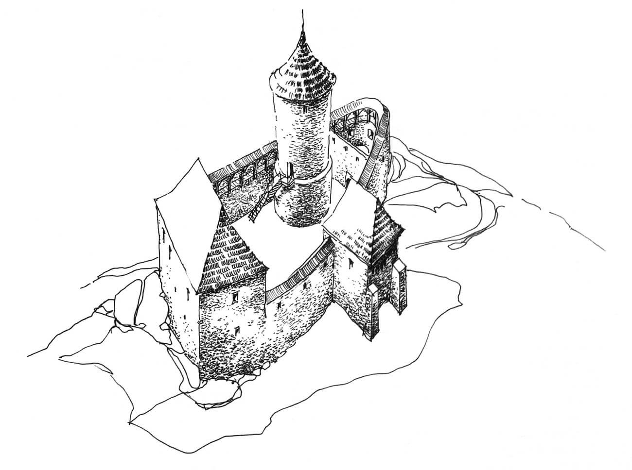
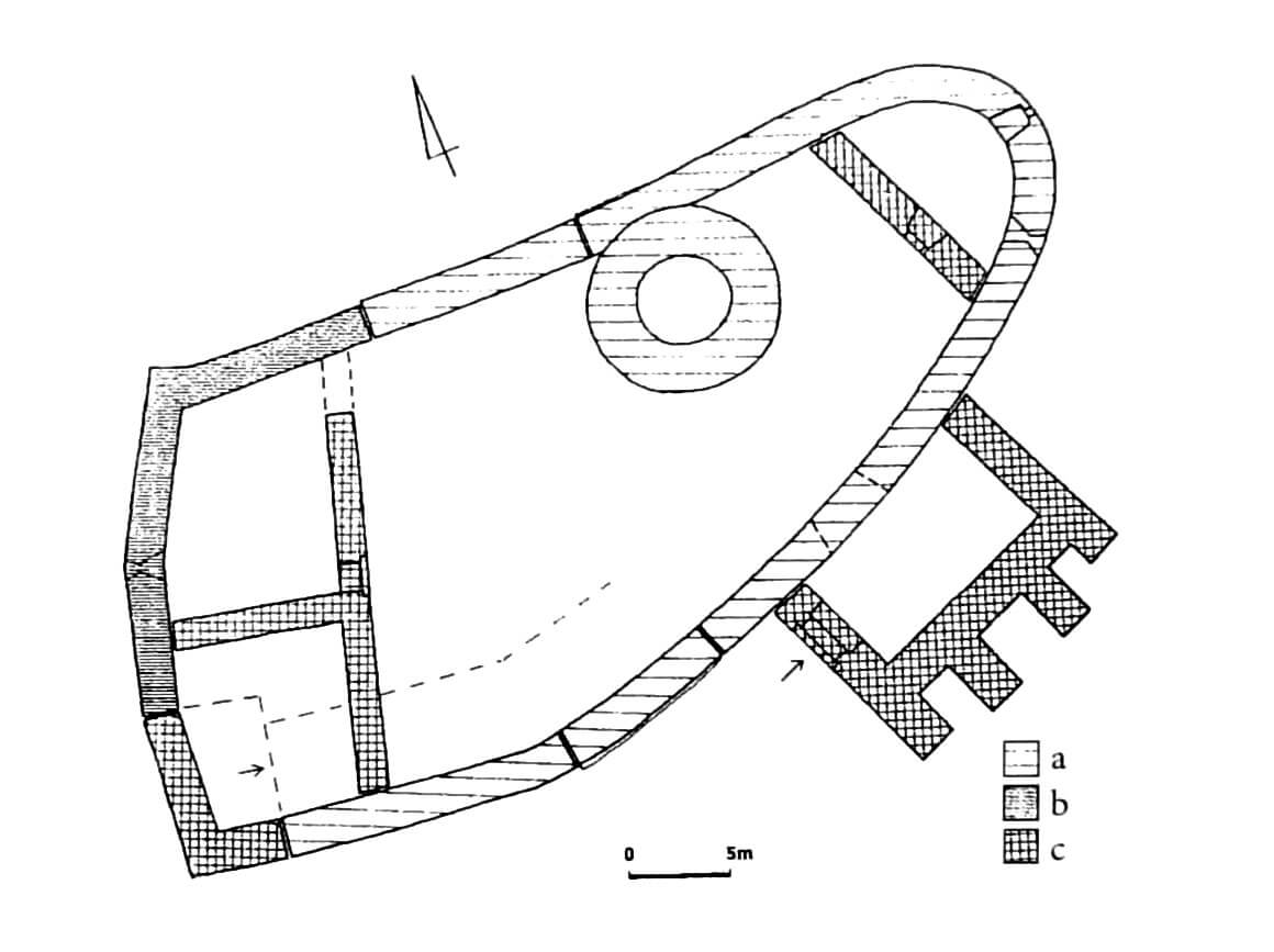
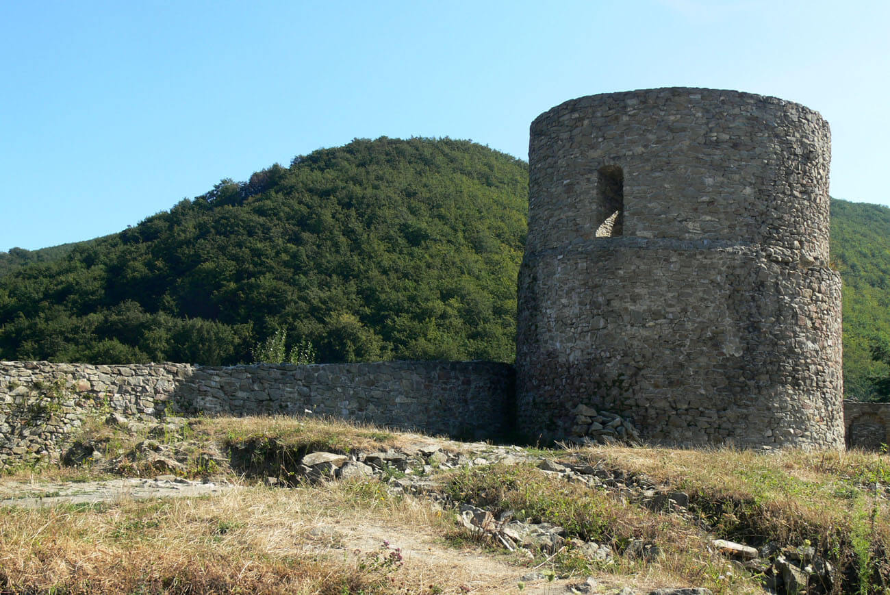
The earliest stone element of the castle was a cylindrical tower built of sandstone, with a diameter of 9.5 meters. Its walls at the base were 3 meters thick, and the entrance opening was almost 6 meters above the level of the courtyard, just above a significant step in the wall. Originally, it could be accessed by a ladder, and later probably from a wooden porch on the defensive wall. It was a typical example of a bergfried, situated in the highest place on the terrain, i.e. a tower serving as the final place of defence and shelter, not intended for permanent residence in peacetime due to the harsh living conditions.
In the second phase a massive perimeter wall was erected, 2.2 to 2.4 metres thick at the ground level, built in sections along the edges of the hill slopes. It had an irregular shape adapted to the form of the terrain, similar in plan to an elongated triangle, with a rounded frontal corner. The tower was located in the northern, southward-sloping part of the courtyard. The wall was connected to the tower, but its entire body was located within the courtyard. The eastern, rounded corner of the wall, similar in shape to a low tower, was probably of main importance for defence purposes. At the end of the Middle Ages it was closed by a transverse wall with a portal from the courtyard side. The loop holes created in it could have flanked the access road and the foreground of the castle with the bailey.
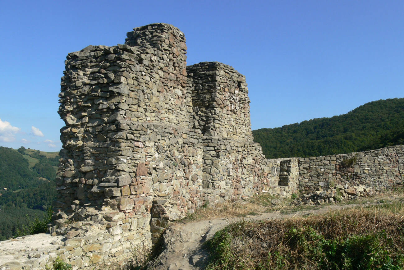
A stone residential house secondarily filled the western, safest part of the courtyard, in such a way that three of its sides were part of the older defensive perimeter. A 1.6-meter-thick wall was directed towards the courtyard. The ground floor of the building was divided into two rooms, with a portal entrance from the courtyard to the northern room. A slit opening was also created in it, indicating the utility purpose of this dark space. The residential chambers traditionally had to be located on the first floor, perhaps with a similar layout, with a larger representative hall and a smaller private residential chamber.
The entrance gate to the castle was initially located in the western, corner part of the southern section of the defensive wall. In the 14th or 15th century, it was moved to the east due to the construction of a stone residential house. From the courtyard side, the southern section by the wall was the only undeveloped area, because the northern section on both sides of the tower could already be blocked by low wooden buildings. Probably in the second half of the 15th century, a quadrangular gatehouse was built in front of the gate, supported from the outside by four parallel buttresses. The entrance opening was located in the western wall, where it was accessible via a wooden ramp and a drawbridge.
Current state
Until today, the castle’s tower has been preserved to the height of 10 meters, a fragment of the western wall of the residential building and smaller relics of the defensive wall and gatehouse. After the reconstruction works carried out in recent years on the crown of the perimeter wall, the castle was opened to visitors. The eastern corner of the castle was roofed and designated as a viewing platform. Unfortunately, in many places metal railings and stairs were installed instead of wooden structures.
bibliography:
Dworaczyński E., Zamek Rytro w świetle najnowszych badań archeologicznych [in:] Zamki w Karpatach, red. J.Gancarski, Krosno 2014.
Leksykon zamków w Polsce, red. L.Kajzer, Warszawa 2003.
Moskal K., Zamki w dziejach Polski i Słowacji, Nowy Sącz 2004.

