History
The oldest wood and earth fortifications in Przemyśl were built in the 9th or 10th century by the West Slavic tribe of Lendians. It were located on a hill near the ford on the San River, in the strategically important area of the Przemyśl Gate, between two forests: Sandomierski from the north and Carpathian from the south. Around the middle of the 10th century, after the capture of neighboring Małopolska, the hillfort of Przemyśl may have come under Czech influence for a short period. Then, at the turn of the third and fourth quarter of the 10th century, it may have come under the rule of the Polans, along with the subordination of the Lendians to the Piast dynasty. Perhaps in connection with these events, the first stone sacral building was built in the Przemyśl stronghold.
According to the Nestor chronicler, in 981 Przemyśl (“Peremyszl”) was captured by the prince of Kiev, Vladimir the Great, together with other strongholds. It remained in the possession of Rus princes until 1018, when was taken by Bolesław the Brave during his military expedition to Kiev. At that time, the first stone palace building was erected in the stronghold, which may have resulted from designation of Przemyśl as one of the most important centers of the early Piast monarchy. It is assumed, however, that not long after the king’s Bolesław death, perhaps around 1030, the Przemyśl hillfort was again under Ruthenian rule, forming part of the Przemyśl Duchy, separated at the turn of the 11th and 12th century. This probably led to the destruction of the Polish buildings, and the erecting of a stone Orthodox church at the end of the 11th century, attributed to the foundation of the Ruthenian prince Volodar.
In short periods Przemyśl often changed its nationality. In the years 1077-1079 during the reign of king Bolesław II the Generous, in the years 1135-1141 during the reign of Bolesław III Wrymouth and in the years 1214-1221 during the reign of Leszek the White remained Polish, while in the period 1215-1216 and 1219-1221 belonged to the Kingdom of Hungary. Then, during the reign of the prince of Galicia–Volhynia, Daniel, who in 1255 received from the Pope a royal crown, and his successors Leo and Yury, remained dependent on the Mongols.
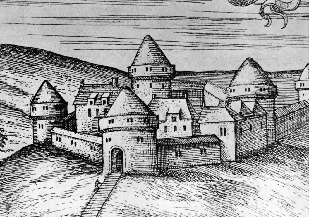
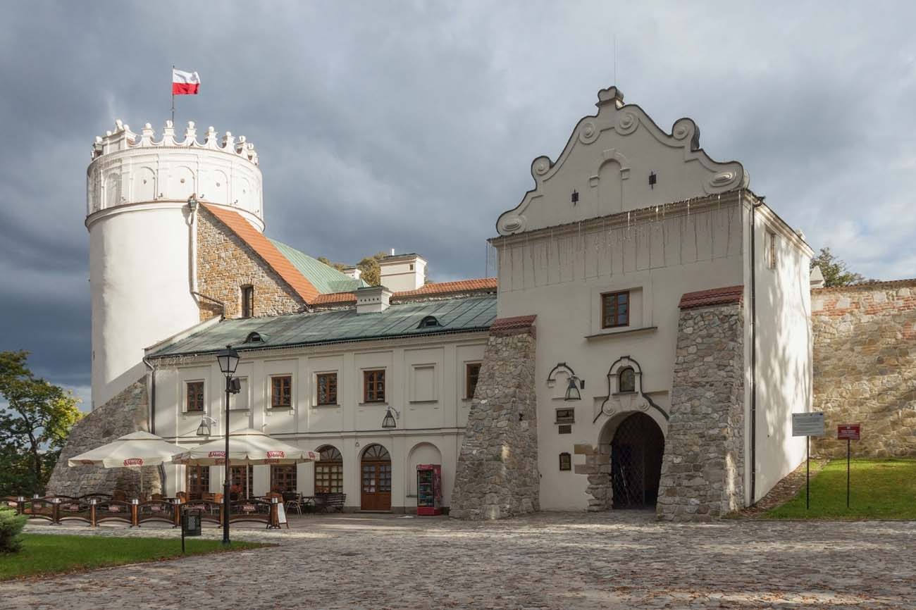
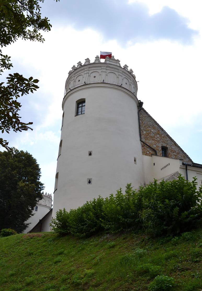
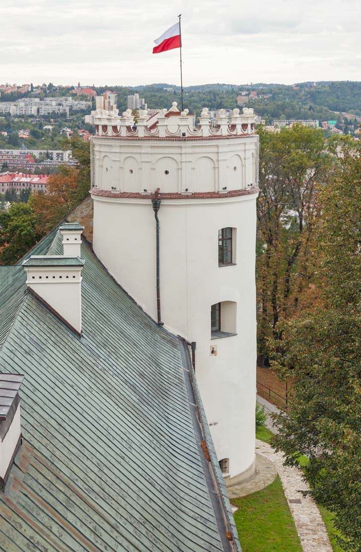
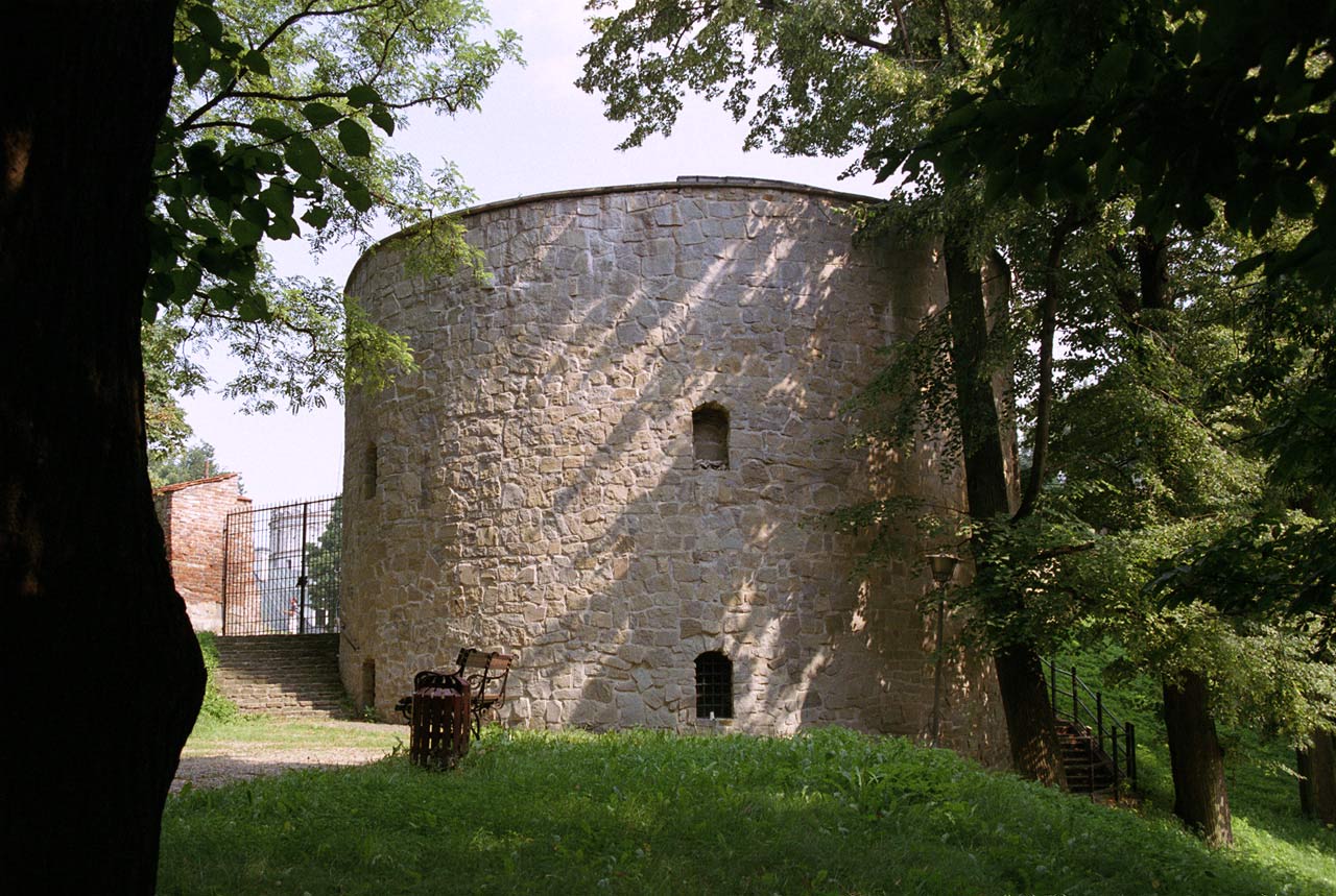
The castle was erected by polish king Kazimierz the Great after 1340, after the land of Przemyśl joined permanently to the Kingdom of Poland. The Ruthenian orthodox church was also incorporated and converted into a Latin cathedral in 1412. In 1470 castle was demolished. In 1498 it was damaged during the invasion of Vlachs. Piotr Kmita Sobieński, the starost of the Przemyśl province, rebuilt it and greatly expanded in the years 1514-1553. Further development by the starosts, changed to a small extent the spatial arrangement of the 16th century castle. In the years 1612-1631 starost Marcin Krasicki raised only north-east residential wing and topped with attic two towers.
In the late 17th century, deprived of regular repairs, the castle began to deteriorate, and only in 1759 starost Stanisław Poniatowski, who later became the king of Poland, carry out a thorough renovation. The southern and western towers were then demolished, and the southwestern wall was moved back a few meters, reducing the area of the castle. In the 19th century, the Austrians converted the castle into a prison. A thorough renovation in the 1970s and 1980s partially restored the appearance of the building from the times of Piotr Kmita.
Architecture
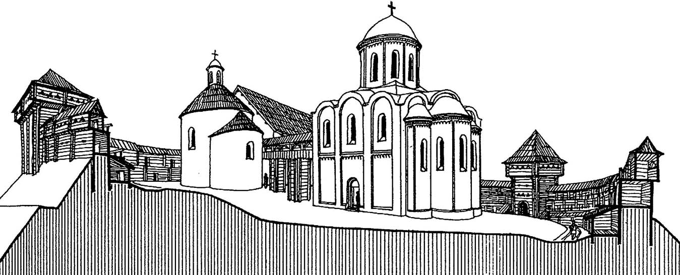
An early medieval hillfort from the 9th-10th century was founded on a high hill on the right bank of the San River. Steep slopes were particularly marked from the south and east, while the other sides were milder. The highest, main part of the stronghold, which was the seat of the feudal ruler, was located in the south – eastern part of the hill, while the lower borough was situated on the north – western side. The whole had an area of about 1 ha and was surrounded by an wood-earth ramparts. Its width at the base was about 20 meters, and its height reached 4-5 meters. Inside the hillfort there were a timber buildings consisting of log huts with dimensions of 3×4 meters, as well as half-dugouts. The huts were located at a distance from the ramparst, separated from it by a road with a width of 2-3 meters.
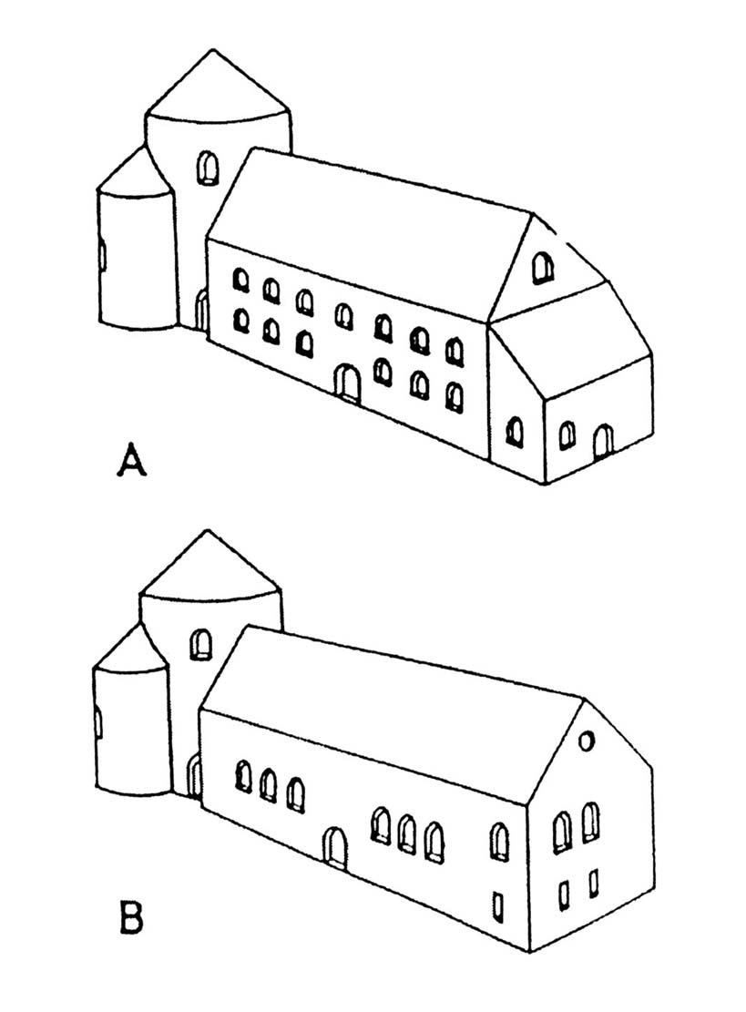
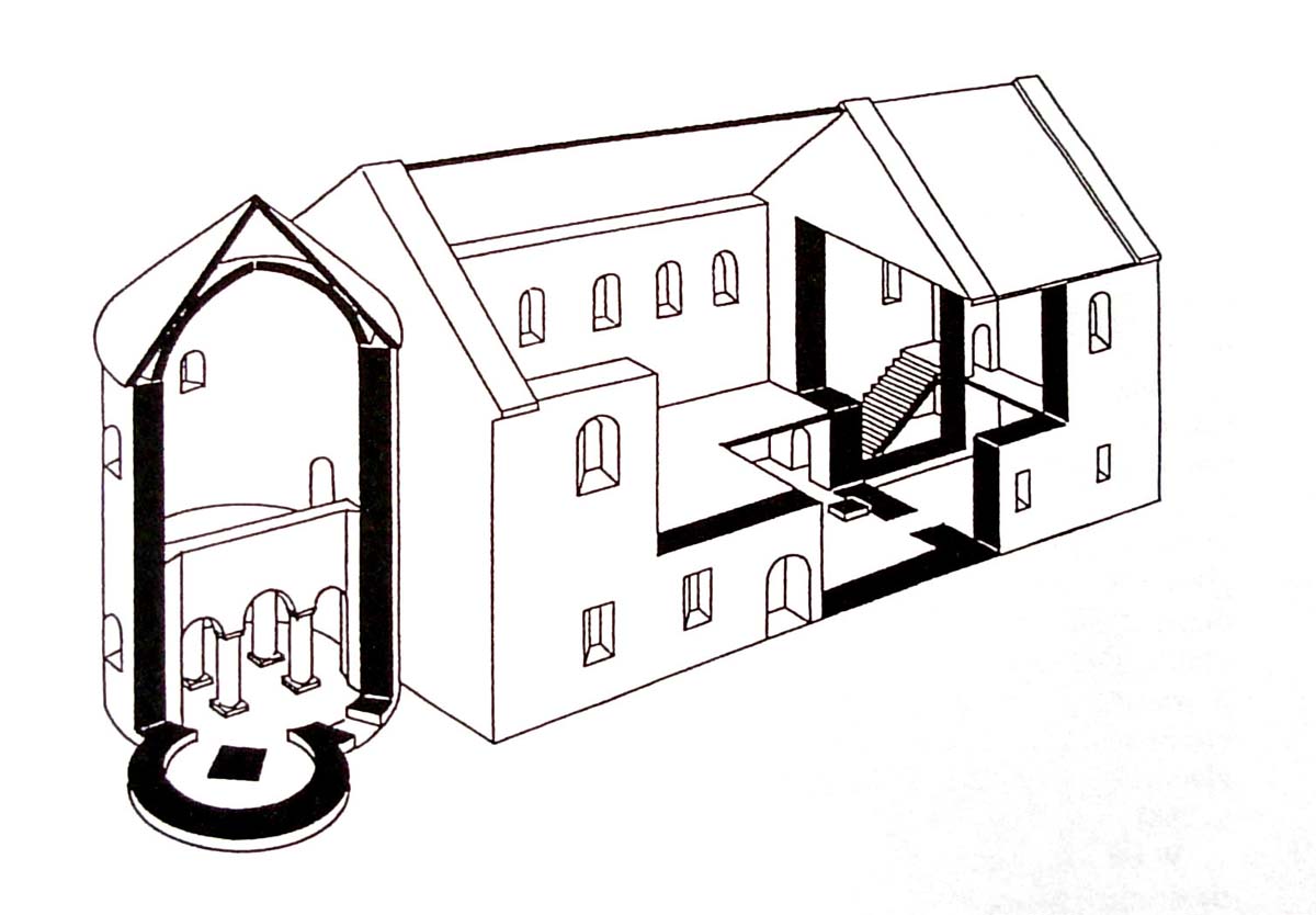
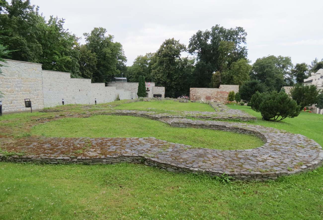
Probably at the beginning of the 11th century, a stone, rectangular palas building was erected in the western part of the stronghold, located next to the adjacent rotunda with an apse. The whole structure resembled similar buildings from Ostrów Lednicki and Giecz, and was therefore attributed to the foundation of Bolesław the Brave, although it cannot be ruled out that the rotunda located in the highest place of the hillfort was built slightly earlier, before the construction of the palas. The foundations of the south-west wall of the palas were made of stones joined with clay, but the remaining parts, both the foundations and the above-ground parts, were built in the opus emplectum technique. The face was made of flat sandstone slabs, arranged in not very regular layers, while the interior of the wall was filled with pebbles and sandstone cemented with lime and sand mortar. The thickness of the palas walls ranged from 1.8 meters to 2.2 meters, only the partition walls were thinner, about 1.3 meters. The rotunda was built of layered, irregular, not precisely worked sandstone slabs, a technology commonly used in Merovingian and Carolingian buildings, and also used in the oldest buildings in Poland (e.g. the Wawel rotunda of the Blessed Virgin Mary, the rotunda in Strzelno, the monastery church in Tyniec).
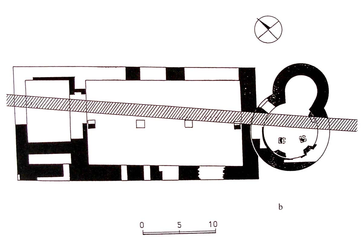
The rectangular palas had external dimensions of 33.6 x 15 meters, with the entrance probably located in the north-eastern wall. Its interior was divided into three rooms of uneven size. The largest, 21.5 x 11.5, probably served as the palace great hall, the next room was 8.2 x 6.3 meters, and the smallest was the narrow, 6.3 x 1.7 meters “passage” in the north-western part of building. Inside the great hall, the remains of two pillars, perhaps supporting a higher storey, were discovered. The narrow passage, on the other hand, could be used as a staircase. The second floor could hypothetically consist of a vast palace hall, or possibly it repeated layout of rooms known from the ground floor.
The circular nave of the rotunda had a diameter of 7.6 meters and walls 1.8-1.9 meters thick. The horseshoe-shaped apse located on the eastern side had slightly thinner walls, about 1.7-1.8 meters wide. The rotunda probably served as a hillfort’s church and a palas’ chapel. It probably had a gallery (matroneum) inside the nave, supported by four columns and four wall-pillars. The lack of traces of communication between the lower level of the nave and the gallery would indicate that the interior of the rotunda was in practice divided into two chapels: the lower one, available to the inhabitants of the stronghold, and the upper one, reserved for the elite, connected to the second floor of the palas. The entrance to the rotunda was located in the northern part of the nave, i.e. in an relatively inconvenient place in terms of use, facing directly the south-eastern wall of the palace building. This would lead to the assumption that both buildings were not built at the same time, but the palas was added to a slightly older rotunda. Moreover, the portal led directly to one of the columns under the gallery, which would indicate that the gallery was also added later.
In the 11th / 12th century, a Romanesque basilica of a Byzantine-Ruthenian character was erected to the north of the palas. It was a temple built of large stone blocks, three-aisle, four-pillar with three apses from the east. Its dimensions were approximately 18 x 22.5 meters. Inside the church, fragments of a stone mosaic floor were unveiled, and the discovered fragments show that the upper part of the outer walls were decorated with an arcaded frieze. It is also known that the interior of the temple was decorated with polychromes with the use of red, yellow and lapis colors.
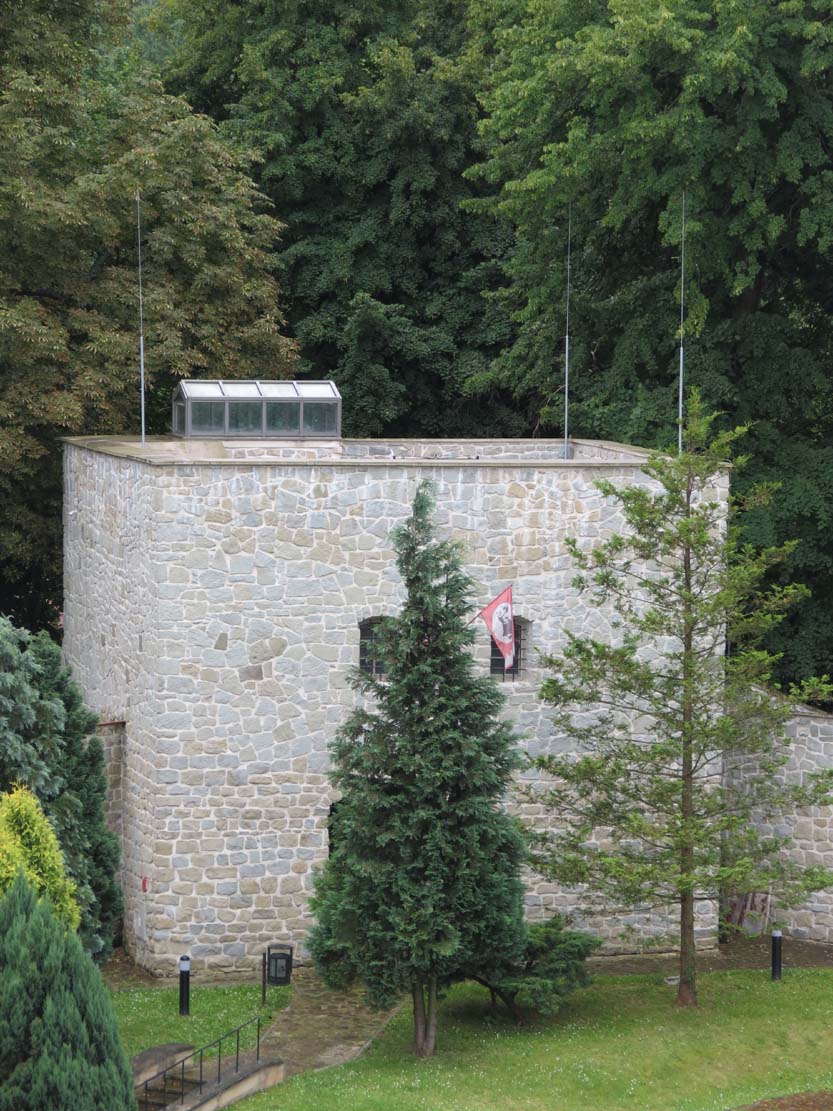
A stone castle of Kazimierz the Great from the mid-14th century was built in the area of an early medieval hillfort. From this poorly recognized period came the tower on a square plan with a side of 9.2 meters. It was connected from the south – west and south – east with the curtain walls. The 16th-century castle had a quadrangle plan with round towers on the corners, and a four-sided tower in the south corner. Curtain walls had wooden porches and a two-storey gatehouse stood at the entry gate. The interior of the castle was filled with wooden buildings. Under the castle was a fortified area of outer ward. Its communication with castle was provided by a timber bridge over the moat. Thanks to the preserved inventory from 1553, it is known that the outer ward had the form of a large semicircular courtyard surrounded by a wooden palisade with an entrance gate and two timber towers.
Current state
The heavily rebuilt castle in Przemyśl consists of a partially rebuilt curtain wall and transformed towers on the north and east sides. The southern and western towers have also been partially preserved. In the courtyard, the outline of the Romanesque rotunda and palas was unveiled, arose at the end of the reign of Boleslaw Chrobry. Information about the cultural events at the castle and prices and opening dates can be found on the official website here.
bibliography:
Leksykon zamków w Polsce, red. L.Kajzer, Warszawa 2003.
Pianowski Z., Przedromański zespół sakralno-pałacowy na grodzie przemyskim w świetle badań z lat 2000–2006 [w:] Architektura romańska w Polsce. Nowe odkrycia i interpretacje, red. T.Janiak, Gniezno 2009.
Pianowski Z., Przemyśl jako “sedes regni” monarchii pierwszych Piastów [w:] Wczesne średniowiecze w Karpatach polskich, red. J. Gancarski, Krosno 2006.
Przemyśl wczesnośredniowieczny, red. Sosnowska E., Warszawa 2010.
Stala K., Uwagi w kontekście ostatnich odkryć w rotundzie i palatium na Wzgórzu Zamkowym w Przemyślu, “Wiadomości Konserwatorskie”, nr 25/2009.
Świechowski Z., Architektura romańska w Polsce, Warszawa 2000.


