
History
It is not known whether the stone fortifications in Gniezno were preceded by wood and earth fortifications. The brick walls were erected at the end of the 13th or 14th century. Iconographic messages indicate that fortifications were created before the 15th century, but there are no references to fortifications during the Teutonic invasion in 1331.
The defensive walls were maintained until the 17th century. It seems that after the fire in 1613, which ruined the town, the walls were no longer brought to a satisfactory state. The information about the attempts at repair has been accompanied by reports of poor fortifications from that time. Nevertheless, in 1629, the city received from king Zygmunt III the privilege of charging the “horn” tax for the repair of fortifications, and the starost accused the townspeople of not taking care of the town fortifications. At the end of the 17th century, the walls were lowered, in order to obtaining a demolition brick. In the 18th century, only city gates played a certain, though not defensive, role.
Systematic demolition began in 1797 from the dismantling of Toruń Gate and Pyzdry Gate, which had been preserved until that time, and from 1800 the gradual demolition of the remaining walls and filling the moats began. The last traces of fortifications were obliterated during the leveling works during the regulation of the town in the 1820s.

Architecture
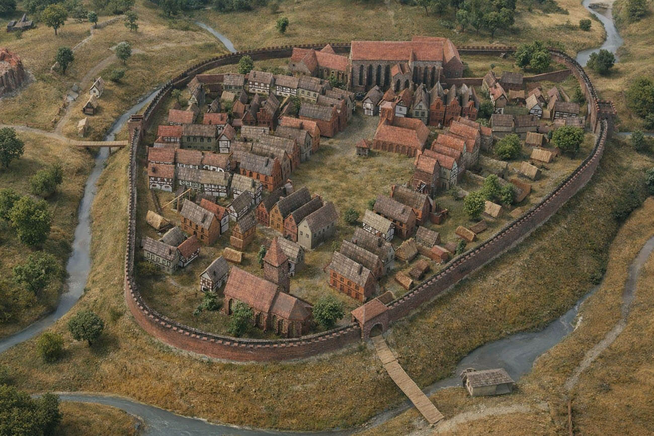
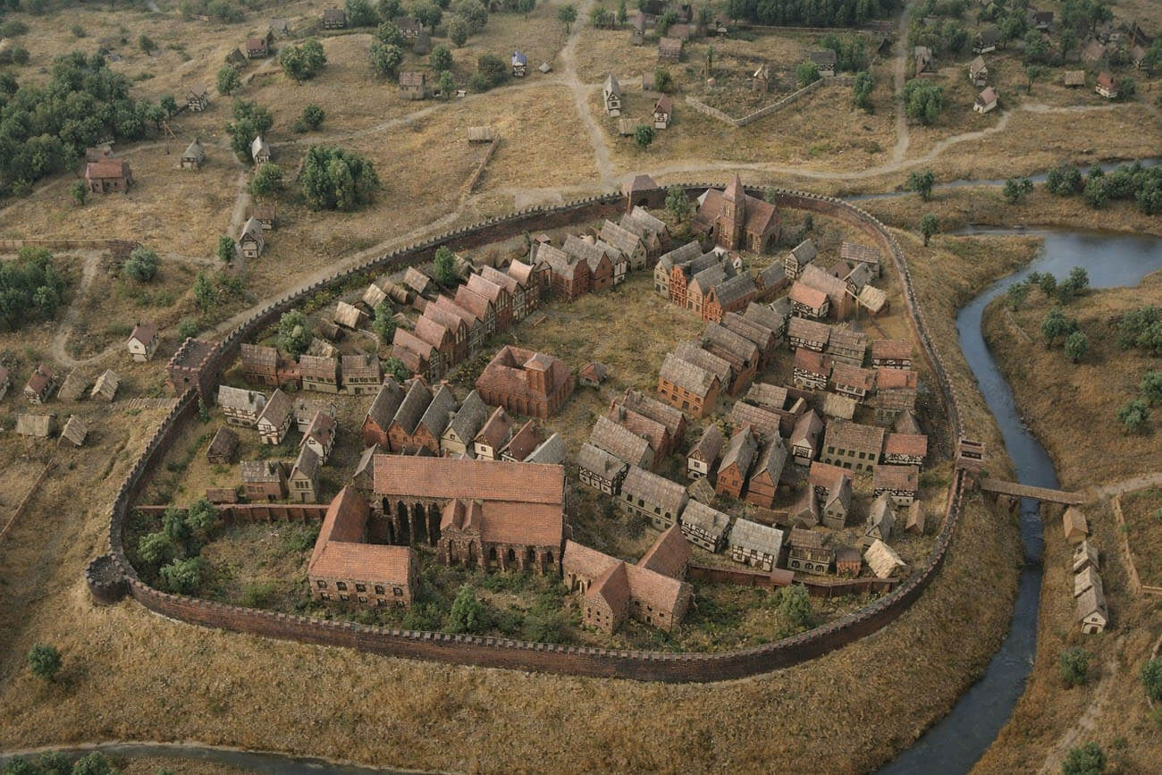
The circumference of the Gniezno defensive walls was irregular, quite compact, adapted to the form of the hill on which the town developed, with a smooth outline. The Srawa river flowed directly on the hill from the west and north. An artificial branch of this river was led along the eastern and southern side of the town, closing a water circle around it, perhaps already before the foundation. The area of the town within the walls was less than 6 ha, and the length of the fortification line was about 850 meters. The town was surrounded by an underwall street, which, due to the urban layout that had already been formed before the construction of the walls, was irregular and of variable width.
The brick defensive wall was topped with a battlement with arrowslits, located, judging from the old views of the town, in each merlon. The dimensions of the wall are unknown. It was not reinforced with towers, and the defense was based on the curtains themselves (as evidenced by the lack of traces of towers from the more endangered south-eastern side, known from iconographic sources).
The town had three gates, located at the outlets of roads formed long before the foundation, converging in the center of the settlement. From the west there was the Poznań Gate (Tumska), from the east Toruń Gate, and from the south Pyzdry Gate, also called the Warsaw Gate, Holy Trinity, Parish, and probably Kaliska or Słupecka Gate. The gates were placed in rectangular towers symmetrically set in the line of the defensive wall. They were not extended horizontally (foregates). It is known from later records that they were closed with doors.
Current state
The town walls in Gniezno have not survived, and there is no visible trace of any of the three town gates.
bibliography:
Tomala J., Murowana architektura romańska i gotycka w Wielkopolsce, tom 2, architektura obronna, Kalisz 2011.
Widawski J., Miejskie mury obronne w państwie polskim do początku XV wieku, Warszawa 1973.