History
The town of Choszczno (Arnswalde) was founded in 1291. Initially, it was protected by wood and earth fortifications, which in the first quarter of the 14th century were replaced by a brick defensive perimeter. The area of the town was expanded, and stone and brick defensive walls were introduced in the place of the palisade until the end of the century.
In the 15th and 16th centuries, the fortifications were rebuilt to adapt to the use of firearms. Traditionally, the greatest attention was paid to the most endangered elements – the gates. Presumably, also then, the curtains of the wall were raised and their finial changed. Perhaps these works were carried out after 1454, when with the outbreak of the Polish-Teutonic war, the Teutonic Knights sold the town together with the New March region to the Electorate of Brandenburg in order to raise funds for the war. They left themselves the formal possibility of rebuying the pledge, but it never happened, and in 1517 the Order finally gave it up.
In the 18th century, the process of dismantling the fortifications began. The ramparts and moats were leveled, only fragments from the south and south-west were left. Also some of the towers were slightened. At the beginning of the 19th century, the gates were dismantled, and over time, houses and economic buildings were added to the remains of the defensive walls. Further damages were brought by the Second World War and post-war renovation negligence.
Architecture
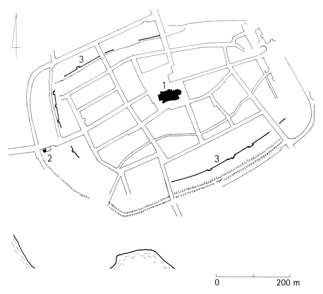
Choszczno was founded between the Stobnica River, which formed swampy and marshy areas in the north, and the lake in the south. The ring of fortifications was erected on a plan similar to an elongated rectangle with dimensions of about 400 x 600 meters, with the longer axis located on the east-west line and with a flattened south-west corner. The total length of the defensive walls was approximately 1,600 meters. The brick fortifications were strengthened by a double system of earth ramparts and moats.
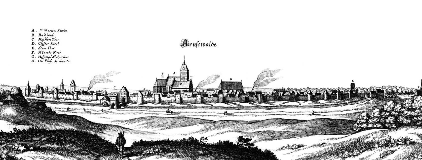
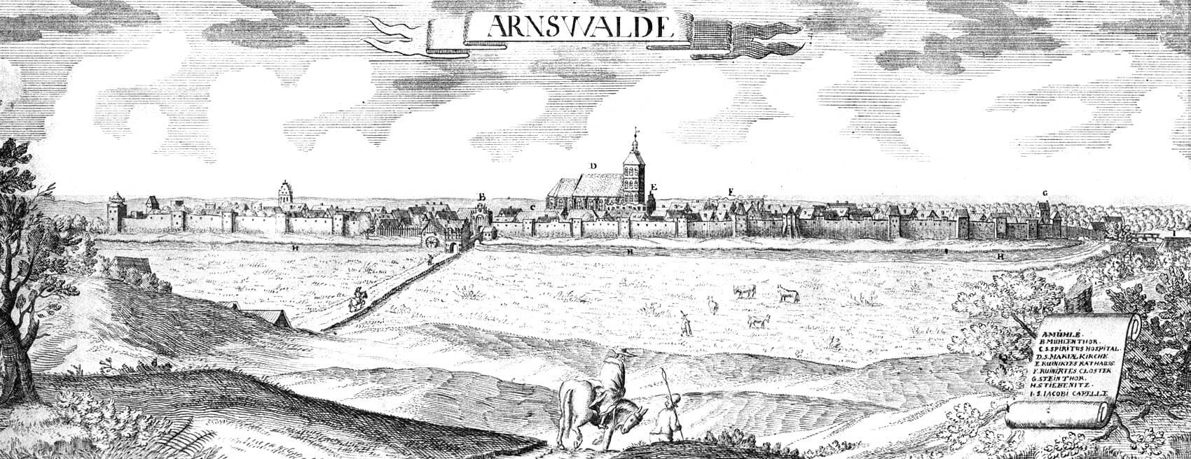
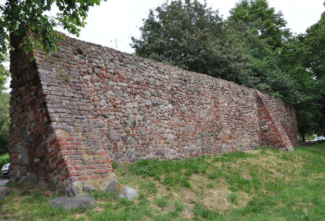
The wall was built of granite erratic stones in the lower parts and bricks in the upper parts, laid in a monk and Flemish bond. The curtains at the end of the Middle Ages were about 8 meters high. Their original culmination was probably a battlement, replaced during the 15th/16th century transformations by a simple parapet with loop holes. Access to the wall was provided by a wooden porch mounted on beams placed from the inside in openings. In addition, rectangular bartizans, visible on the oldest known vedutas of the town, could be hung in the middle of some curtains.
The defensive wall was reinforced with 7 closed towers and 36 half towers, opened from the town side. In the eastern section of the walls, there were five closed towers, in the southern and western sections only one in the corners of the perimeter. The half towers were similarly unevenly spaced – the largest number was placed on the eastern and western sides, i.e. on the sections least protected by the natural conditions of the terrain. The half towers were built on a rectangular plan, protruding in front of the neighboring curtains and higher than them by one storey. Originally it probably did not have roofs, but perhaps already at the end of the Middle Ages, some of half towers were covered and closed with wooden or half-timbered screeens from the town side. The defense was carried out from the loop holes on the second and third floors, while the ground floor could be a warehouse for war materials after being partitioned with a screen. An opened, larger polygonal tower in the northern part of the town was distinguished, most likely the result of the late-Gothic expansion of the fortifications.
The entrance to the town led through three gates: Stone Gate from the west, leading to the route to Barlinek and Myślibórz, High Gate from the south-east, leading towards Dobiegniew, and Mill Gate from the north, with a passage directed towards Szczecin. All of them had the form of four-sided towers with passages in the ground floor. At the turn of the 15th and 16th centuries it were extended with foregates and drawbridges. The gate complex then consisted of a main tower, a straight neck and an external gatehouse, while the foregate of the Stone Gate was strengthened by at least one round, three-story tower with a diameter of 8.6 meters and a height of about 7.5 meters. Perhaps a similar tower was located on the north side of the gate foregate’s passage.
Current state
Today, the most known element of the medieval fortifications of Choszczno is the Gothic tower from the foregate of the Stone Gate, also known as the Barbican. It was partially reconstructed after World War II, therefore only a fragment of its wall on the western side is original, and the remaining parts are faced with demolition bricks and a new ones with Gothic dimensions. The longest section of the walls, 334 meters long and of a maximum height less than 5 meters, is located on the north side. It extends from the exit Stargardzka Street to Moniuszko Park, along Bohaterów Warszawy Street. From the west, on the edge of Moniuszko Park and Piastowska Street, four fragments of the wall have survived, including one south of Wolności Street. On the south side along Wały Piastowskie Street, from Bolesława Chrobry Street to the corner of Władysław Jagiełło Street, there are two fragments connected by very low relics of the wall (these two high fragments of the wall are located at the edge of Mur Południowy Street). From the east, only one small fragment of the wall is visible at the end of Jagiełło Street to Stargardzka Street. The preserved sections of the walls have been heavily refaced in some places. They do not reach their full height anywhere, but several half towers have survived in their line. In addition, south of the former line of walls, an earth rampart has been preserved, along which the promenade now runs.
bibliography:
Biała karta ewidencyjna zabytków architektury i budownictwa, mury obronne, K.Kalita-Skwirzyńska, nr 1142, Choszczno 1996.
Lukas E., Średniowieczne mury miejskie na Pomorzu Zachodnim, Poznań 1975.
Pilch J., Kowalski S., Leksykon zabytków Pomorza Zachodniego i ziemi lubuskiej, Warszawa 2012.


