History
The castle in Bobrowniki was probably built on the site of an older stronghold, recorded in document from 1349. The construction of the brick structure could have begun around the mid-14th century, funded by Władysław the Hunchback, Prince of Dobrzyń, although archaeological research would indicate the end of the 14th century as the period when construction work began. In the latter case, the founder of the castle could have been Prince Władysław of Opole, who held the Dobrzyń land as a fief in the years 1379-1392. The finishing works could also have been carried out by the Teutonic Knights, who occupied the local lands between 1392 and 1404, although documents provide information about only minor construction works than.
During the Polish-Teutonic wars of the second half of the 14th century and the beginning of the 15th century, due to its border location, Bobrowniki passed from hand to hand. In 1391, the castle withstood a siege by Polish troops, but in 1404, thanks to the efforts of King Władysław Jagiełło, Poland regained the Dobrzyń Land along with Bobrowniki. A year earlier, the settlement near the castle obtained the status of a town, and with it favorable rights and privileges ensuring development. As a result of the outbreak of the Polish-Teutonic War in 1409, the castle was once again captured by the Teutonic Knights. Finally, after the conclusion of the First Peace of Toruń in 1411, it passed to the Polish Kingdom and was expanded with external fortifications on the initiative of Władysław Jagiełło.
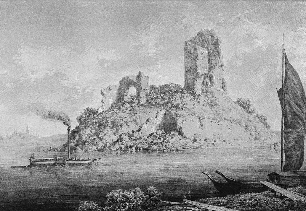
The loss of the military significance of Bobrowniki Castle occurred after the end of the Thirteen Years’ War and the signing of the Second Peace of Toruń in 1466. The end of the devastating Polish-Teutonic conflicts, and especially the shifting of the border, meant that the castle was no longer an advanced defensive point. It housed the seat of the starosts along with the town archives, and periodically probably served as a prison, for example during the last Polish-Teutonic war of 1519-1521, when war prisoners were held there. In the mid-17th century, the castle was devastated by the Swedes, although as shown in a graphic from 1627, it had already been in decline and partially ruined. In the 18th century the ruins were used by the local population, who obtained free building materials. Finally, in the 19th century, it was almost completely slightened by order of the government of the Congress Kingdom.
Architecture
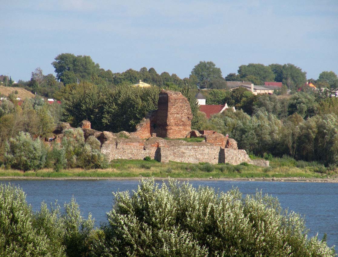
The castle was situated on an artificial, not very high elevation of the terrain, on the right bank of the Vistula, the riverbed of which protected it from the west and partly from the south. On the other sides protection could be provided by a watered moat or one of the side branches of the Vistula. In the immediate vicinity, the small Gryzka River also had its mouth, flowing from the east of the castle and into the Vistula in the north. A settlement and later the charter town of Bobrowniki developed on this river, east of the castle.
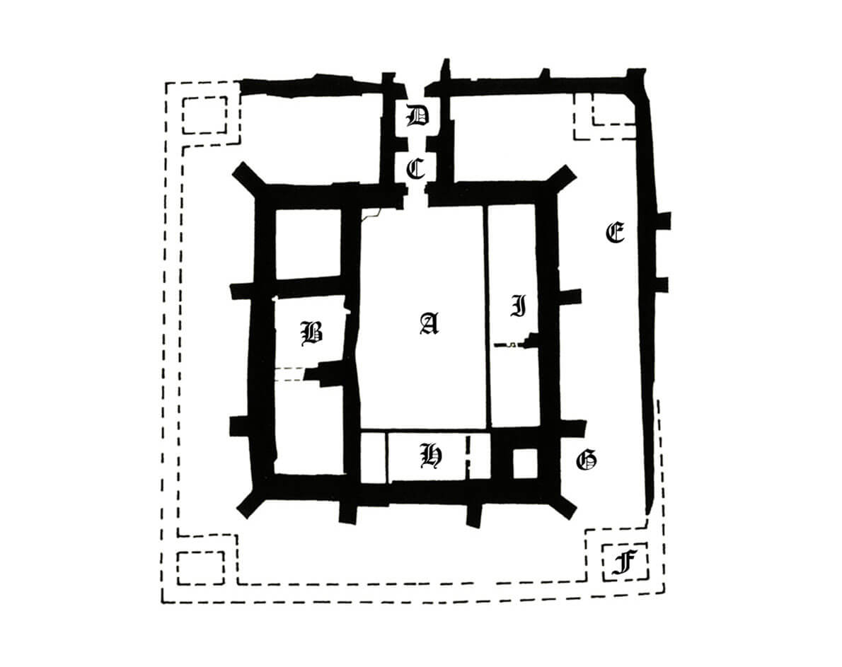
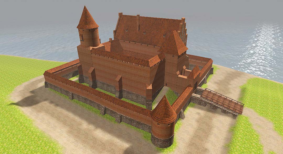
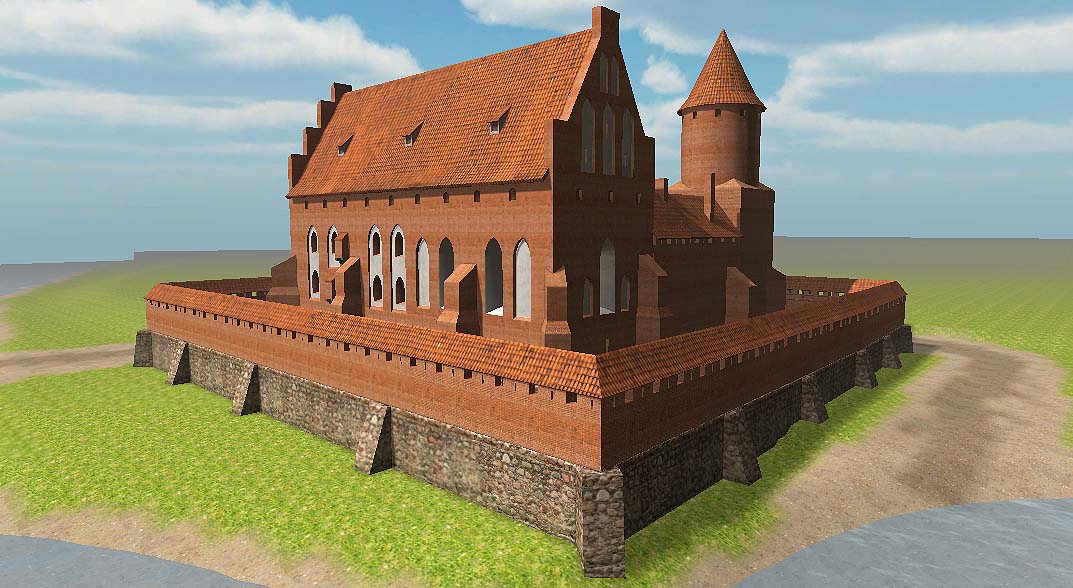
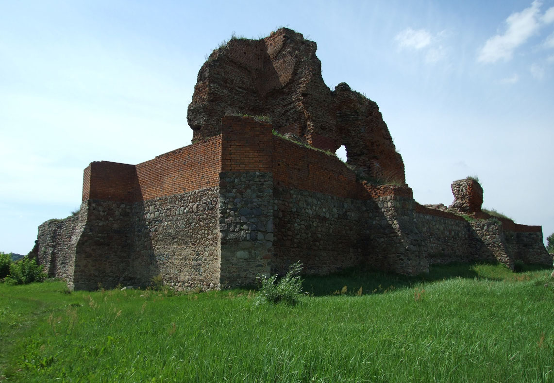
The oldest core of the castle was built on a square plan with sides of about 46.5 meters long. It consisted of straight curtains of defensive walls, the main house forming the western part of the castle, a cylindrical tower with a quadrangular base measuring 10.7 x 11.2 meters in the south-eastern corner and a gatehouse. The latter was located in front the northern curtain, on a plan close to a square measuring 10.5 x 11.5 meters. The interior of its ground floor housed a vaulted gateway with a passage about 3 meters wide and a small, also vaulted guard’s room. The perimeter walls, despite their impressive thickness exceeding 3.5 meters, were reinforced from the outside with buttresses, both diagonal corner ones and perpendicular ones in the course of the curtains, due to the proximity of the river and the unstable ground. Since the gatehouse housed posterns in the side walls, external fortifications in the form of a palisade could have functioned before the construction of the second brick perimeter. In the late Middle Ages, the castle courtyard was paved and equipped with a rainwater drain running through the center.
The main residential house was built on a rectangular plan measuring 15 x 46 meters. It housed rooms in a single-line layout, including the lowest storey partially sunk into the ground, above which there were probably two more floors and an attic, covered with a gable roof based on triangular gables. At the basement level, the interior was divided into three rooms, and this division was probably repeated on the upper floors. The attic, usually used for storage purposes, could have been a single-space structure. The second, smaller building was located between the main tower and the main house, along the southern curtain wall. In addition, there could have been wooden buildings at the eastern section of the wall, fulfilling auxiliary economic functions.
In the 15th century, the castle was expanded by a circuit of brick external wall, located about 12.5 meters from the main circuit and also reinforced with buttresses. Unusually it was of considerable thickness, similar to the inner ring of fortifications. In the 15th century, the gatehouse was also extended by the foregate, and small towers were built in the corners of the second circuit, perhaps adapted for the use of firearms. It could have quadrangular plans, placed entirely within the zwinger area, or more progressive, cylindrical. The external zone of defence was the above-mentioned watered moat, surrounding the castle from the land side. Later reconstructions, perhaps still in the late Middle Ages, involved the construction of earth ramparts that protected the castle from the north and east.
Current state
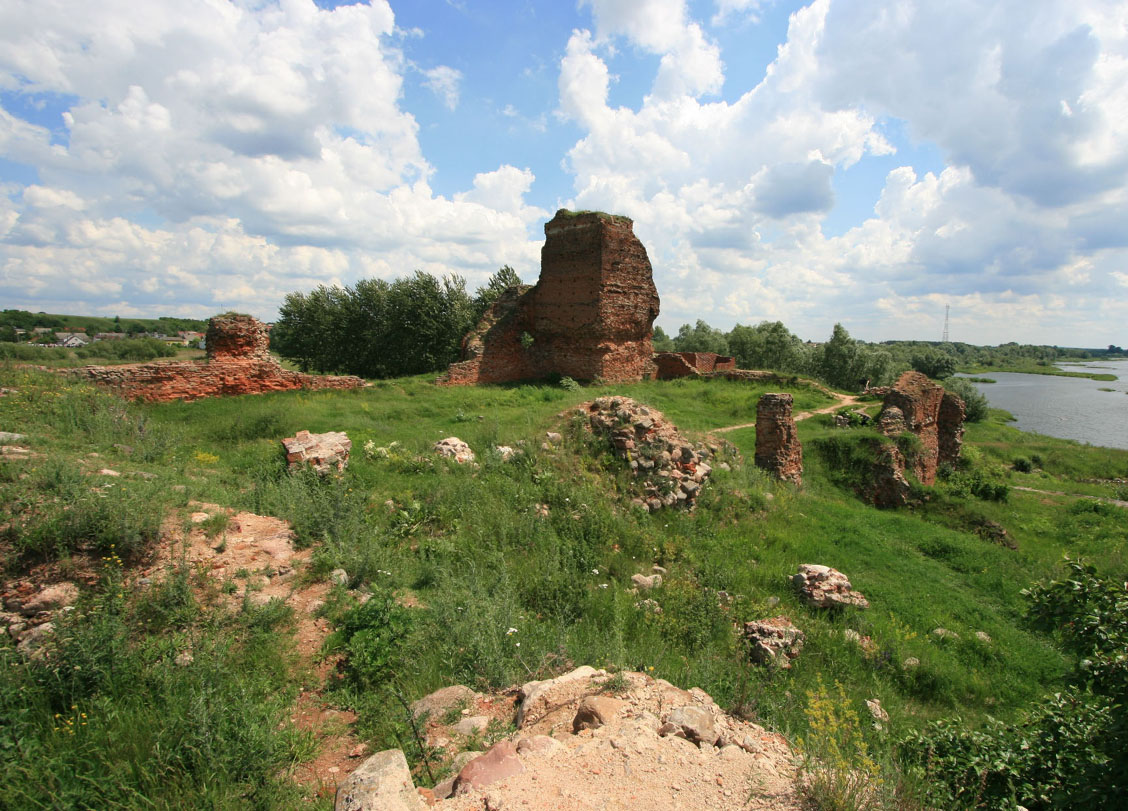
Currently, the only traces of the former glory of the building are fragments of the defensive walls with buttresses, mainly in the ground-level, stone part of the perimeter, as well as relics of the corner main tower, which at its highest point has survived to a height of 11.8 meters. The main residential building is degraded to the lower parts of the walls, with the interior partially covered with rubble from the collapsed parts of the building. After being extracted from the piles of rubble, the gatehouse currently reaches the ground floor, while the foregate is marked slightly above the original ground level. The outer defensive wall survived in the worst condition, almost completely destroyed on the southern and western sides by the Vistula floods. The castle walls were secured, supplemented and partially reconstructed in the 1970s and 1980s, and work was also carried out at the Vistula bank at that time to protect the monument from being washed away, and the side riverbed was filled in, thanks to which the castle became generally accessible from the land side. The picturesque ruins are open to visitors today.
bibliography:
Krysiński M., Trochonowicz M., Zamek w Bobrownikach – problematyka techniczna i konserwatorska [in:] Ochrona i konserwacja ruin zamkowych: wybrane problemy i przykłady, Warszawa-Lublin 2013.
Leksykon zamków w Polsce, red. L.Kajzer, Warszawa 2003.
Pietrzak J., Zamki i dwory obronne w dobrach państwowych prowincji wielkopolskiej, Łódź 2003.


