History
The building of the castle probably began around the middle of the 14th century, while the first record of it was in 1359 (“castrum Smilteselle”). It was located in an important strategic location, as it controlled a narrow strip of land belonging to the Archbishopric of Riga, which was connected to the Bishopric of Dorpat and at the same time divided the lands of the Teutonic Order. Thus, this strip enabled a connection between two episcopal powers independent of the order. In addition to its military and administrative function, the castle was also a regional center of trade together with the nearby settlement.
In 1556, the castle was occupied by the Teutonic Knights, who held the captured archbishop there. During the Livonian Wars, due to its location, Smilten was exposed to attacks by Muscovite troops, which destroyed the building twice, in 1559 and 1560. After the withdrawal of Ivan the Terrible’s troops, the authorities of the Polish-Lithuanian Commonwealth established a starosty in the castle. However, this rule did not last long and in the first half of the 17th century Smilten passed under Swedish rule. The final destruction of the castle was brought by the Swedish-Russian war in 1702.
Architecture
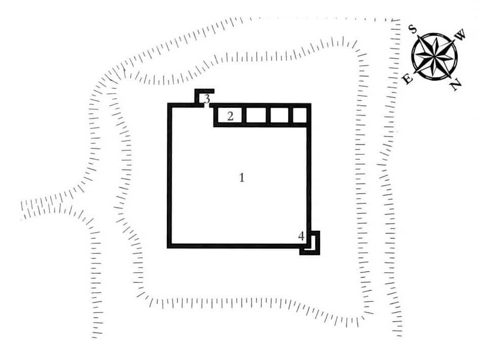
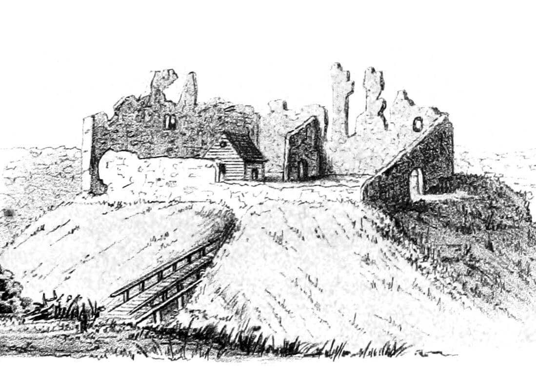
The castle was built on a small hill in one of the bends of the Abuls River. It consisted of a defensive wall preceded by a ditch, surrounding a large courtyard of almost square shape measuring 60 x 60 meters. The large free space of the courtyard could have been used for temporary camps for merchant carts, armed units or transports with supplies. The living quarters were located in an elongated building forming the north-western part of the perimeter. The main gate, probably placed in the gatehouse protruding from the perimeter of the walls, was located on the south-western side of the courtyard, right next to the residential building. Another defensive element of the castle was a small tower placed in the northern corner of the walls.
The north-western residential building, according to post-medieval plans, was divided into four rooms on the ground floor. Probably following the example of other buildings of this type, it housed utility and auxiliary rooms on the ground floor. The living quarters must have been located on the first floor, probably accessible via a wooden porch from the courtyard. A modest refectory could have been there, and perhaps also a chapel.
Although the castle’s architecture qualified it for the category of a so-called camp castle, i.e. a roadside building with a spacious courtyard where armed units or merchant wagons could camp, on the western side of the castle there was another large courtyard, surrounded by wooden fortifications in the type of a palisade. In addition, the castle house was complemented by economic buildings located on the river, such as a mill and a brewery.
Current state
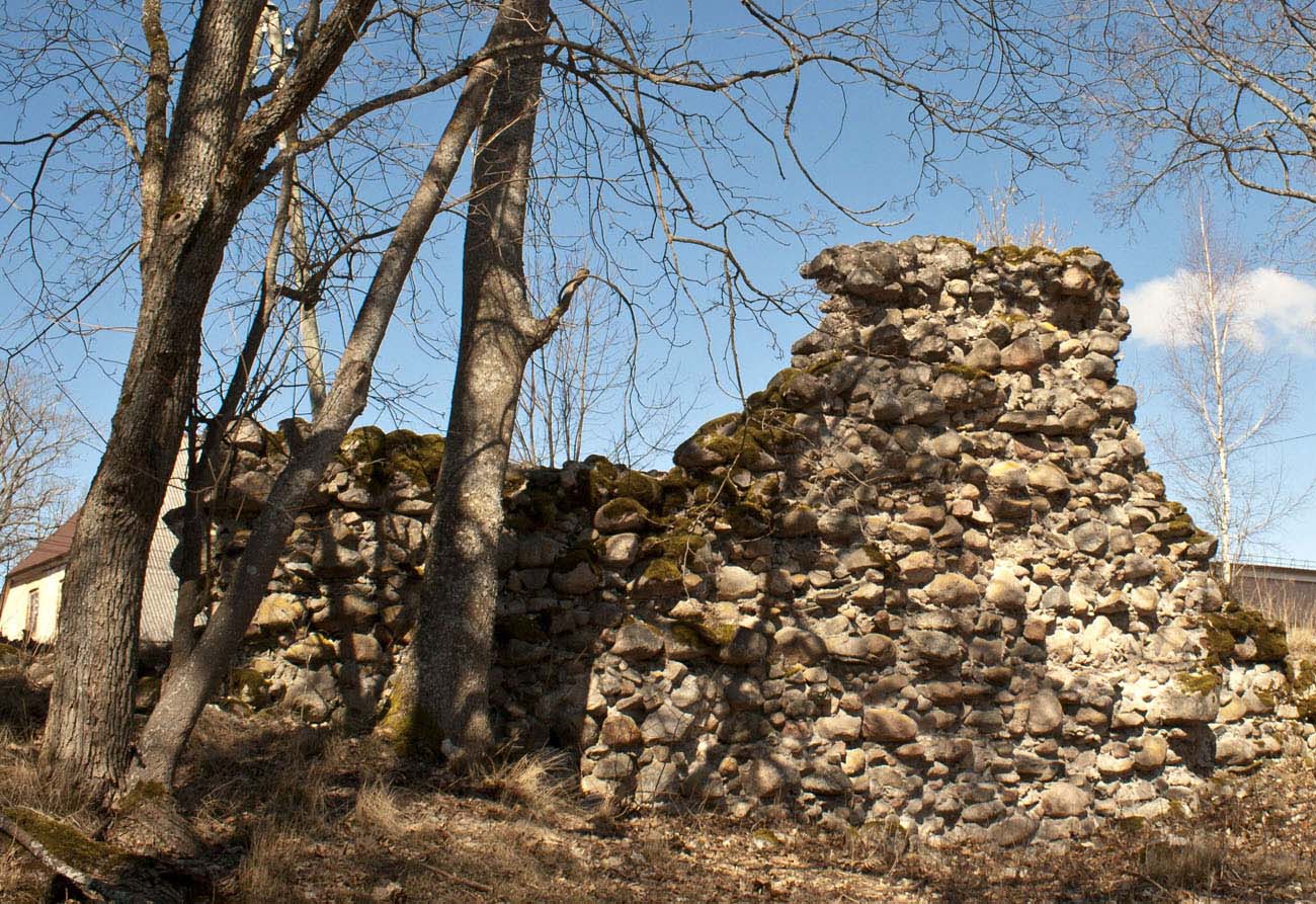
Currently, only small fragments of the perimeter wall have survived from the castle, located between modern residential buildings. In the highest parts, the original sections of the walls reach about 5 meters high. Most of them are covered with roofs protecting against rain and wind and supported by iron rods. The earth ramparts visible around the castle date back to modern times, when bastion fortifications were built around the medieval structure. The castle ruins are located on the north-eastern side of the manor house, in the northern part of the town.
bibliography:
Borowski T., Miasta, zamki i klasztory. Inflanty, Warszawa 2010.
Herrmann C., Burgen in Livland, Petersberg 2023.
Tuulse A., Die Burgen in Estland und Lettland, Dorpat 1942.


