

History
The tower was established at the earliest at the end of the twelfth century and probably functioned until the end of the 13th century, although its use may have lasted longer. It was certainly a multi-phase structure, because the remains of the original tower were used after some time. Its walls were raised with the use of the same building material, but made of stone of slightly smaller dimensions, the lowest, vaulted floor was also buried then.
Today it is difficult to determine the founder of the tower. It may have been prince of Halych-Volyn Daniel, about whom Ruthenian chronicles indicate that while having settled down in Chełm, he had built a tower. Apart from the military defensive nature of the building, newer sources emphasize the sacral character of the monument. It could have been a monastery tower where the great duchess, Roman Halicki’s wife, lived, who, after her husband’s death at the Battle of Zawichost in 1205, settled in an unidentified location, probably near Chełm. It is believed that it could have come from Byzantium, where similar towers were erected as private chapels for members of the aristocratic elite.
The study suggests that in the eighties of the thirteenth century the facility underwent secondary militarization. There was a small fortified complex consisting of a tower, palisades and a moat. This complex was rapidly destroyed at the turn of the thirteenth and fourteenth centuries, or at the latest around the mid-fourteenth century. The destruction was the result of a fire, very likely associated with the raid. The stronghold was no longer rebuilt, and the tower gradually began to fall into ruin.
Architecture
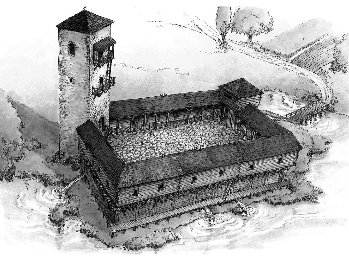
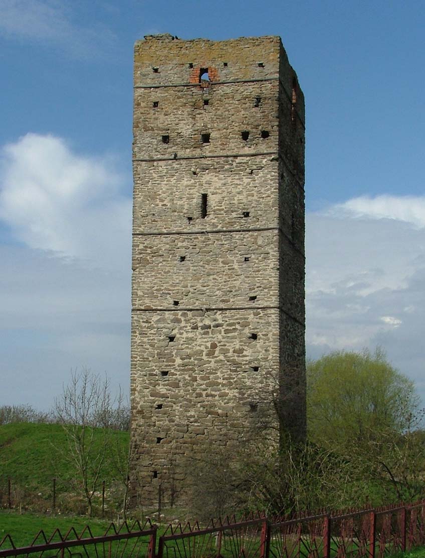
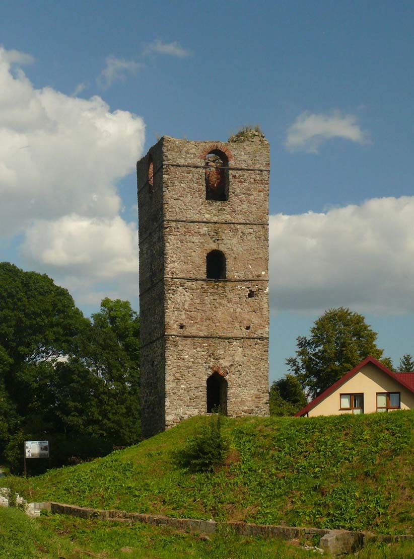
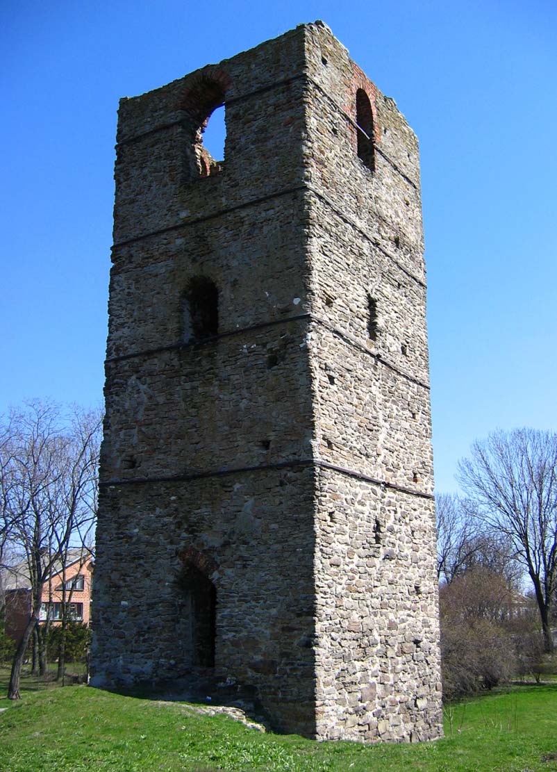
The tower was erected east of the Garka river, at the outlet of a small valley ending in a niche with steep edges. Its walls, up to 19-20 meters high, were built of unworked, local stone combined with sand-lime mortar. The thickness of the tower walls was from 1.2 to 2 meters, while on the west side the building was reinforced with a 0.3-0.6 meter wide offset. The tower received in the plan a rectangular shape measuring 5.7 x 6.3 meters, while the interiors of four floors were formed into circular rooms with a diameter of 3 to 3.6 meters. The top floor was even more unusual, on an octagonal plan. On the outer façades of the tower, there were left putlog holes and openings for the beams supporting the timber gallery, also slit openings and large windows on the top floor were pierced.
The interior of the tower was divided into five floors with wooden ceilings. The lowest one was to serve as a warehouse, treasury or prison, the second was a utility room, perhaps a kitchen, the third was alcove-bedroom, and the fourth a representative and residential room. The top floor was probably occupied by an octagonal chapel with an apse in the eastern wall and numerous smaller wall niches. The decor of this floor was richer than others: the walls were lined with bricks and the floors had glazed tiles.
Next to the tower, on the south-west side, there was a rectangular stone platform measuring 12.5 meters by 15.4 meters and about 2.5 meters high, originally a form of a timber stronghold. The entrance to the courtyard was from the south, while the entire complex was surrounded from three sides by a water reservoir fed with local sources. On the fragment of land at the foot of the fortifications, and right next to the water, wooden bridges were created, the existence of which is found by the remains of timber poles and hardened surfaces. It probably allowed the inhabitants to directly take water. On the fourth, eastern side, the stronghold and the tower were protected with a moat of several meters width and edges reinforced with logs. It had a defensive function and at the same time drained the water flowing down the valley from the slope of the hill.
At the second stage of the stronghold’s functioning, probably after 1284 (date obtained by dendrochronological studies), it was rebuilt by erecting a wood and earth rampart crowned with a palisade. The crown of the rampart was formed by timber fortifications in the form of a reinforced fence about 1 meter wide. The base was made of poles spaced from each other at a distance of 0.3-0.4 meters, and the space between them was filled with soil with stones, and limestone loam additionally protecting the poles. The face of the structure from the outside was also protected by a layer of clay with stones. At the time, the courtyard of the stronghold housed a wooden building with a length of about 3.8-4 meters, moreover, in other parts of it were found remains of wood. In the eastern part, between the fortifications and the building, there was a communication route about 2-2.2 meters wide. It was the link between the entrance to the courtyard and the tower, separating the defensive ward from the economic one.
Current state
The tower has survived to our times in quite good condition. It is now considered to be the oldest monument of Romanesque architecture in Eastern Poland, and by its reference to Byzantine culture its a unique construction. The tower avoided major transformations in the early modern period, only the present form of the room on the top floor may be the result of renovation works carried out at the end of the 19th century. It cannot be ruled out that the reconstruction duplicates the original form of the room, although due to the use of old bricks of various origins, it is difficult to distinguish between primary and secondary parts. The few stones with which the courtyard was paved are still visible near the tower.
bibliography:
Buko A., Średniowieczne kamienne wieże ziemi chełmskiej, “Przegląd Archeologiczny”, vol. 62, 2014.
Dzieńkowski T., Pomiędzy Wschodem i Zachodem. Zespół architektoniczny w Stołpiu [w:] Zamki Lubelszczyzny w źródłach archeologicznych, red. E.Banasiewicz-Szykuła, Lublin 2015.
Leksykon zamków w Polsce, red. L.Kajzer, Warszawa 2003.